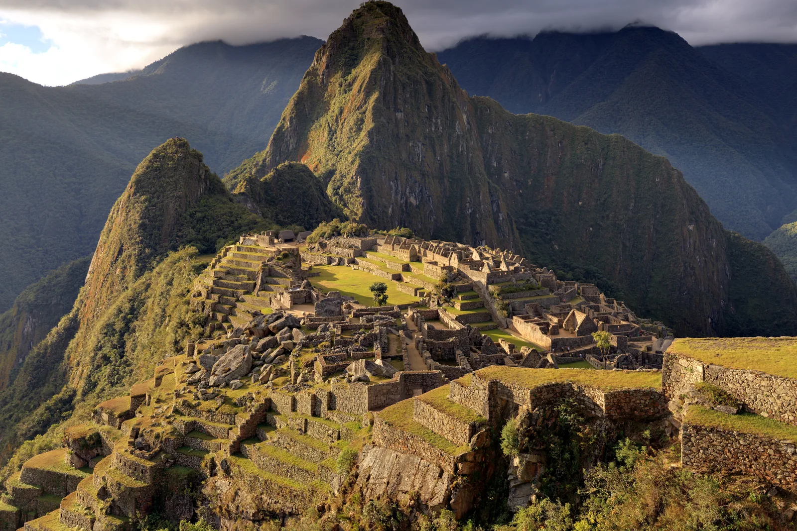
Machu Picchu in evening light: terraces and stone houses of the Inca city on the ridge, with the steep peak of Huayna Picchu behind.
Machu Picchu from the upper terraces near the Guardian’s Hut: the main plaza with its single tree, the temple sector on the left, the residential quarters on the right, Huayna Picchu behind. Photograph taken on 27 June 2009 in evening light. Martin St-Amant (S23678) · CC BY-SA 3.0

Peru · Inca

Machu Picchu.
An estate nobody wrote down.

From the guardhouse you see the town whole: terraces holding the ridge, houses below them, the plaza in the middle, the cone of Huayna Picchu behind. No Spanish chronicler described this place. What you know about it comes from the stones, from the graves in the caves around it and from a few lines in sixteenth-century legal papers.

1450CE
Selection: 1400–1572 CE8 chapters
The history
On the ridge between the Andes and the Amazon.

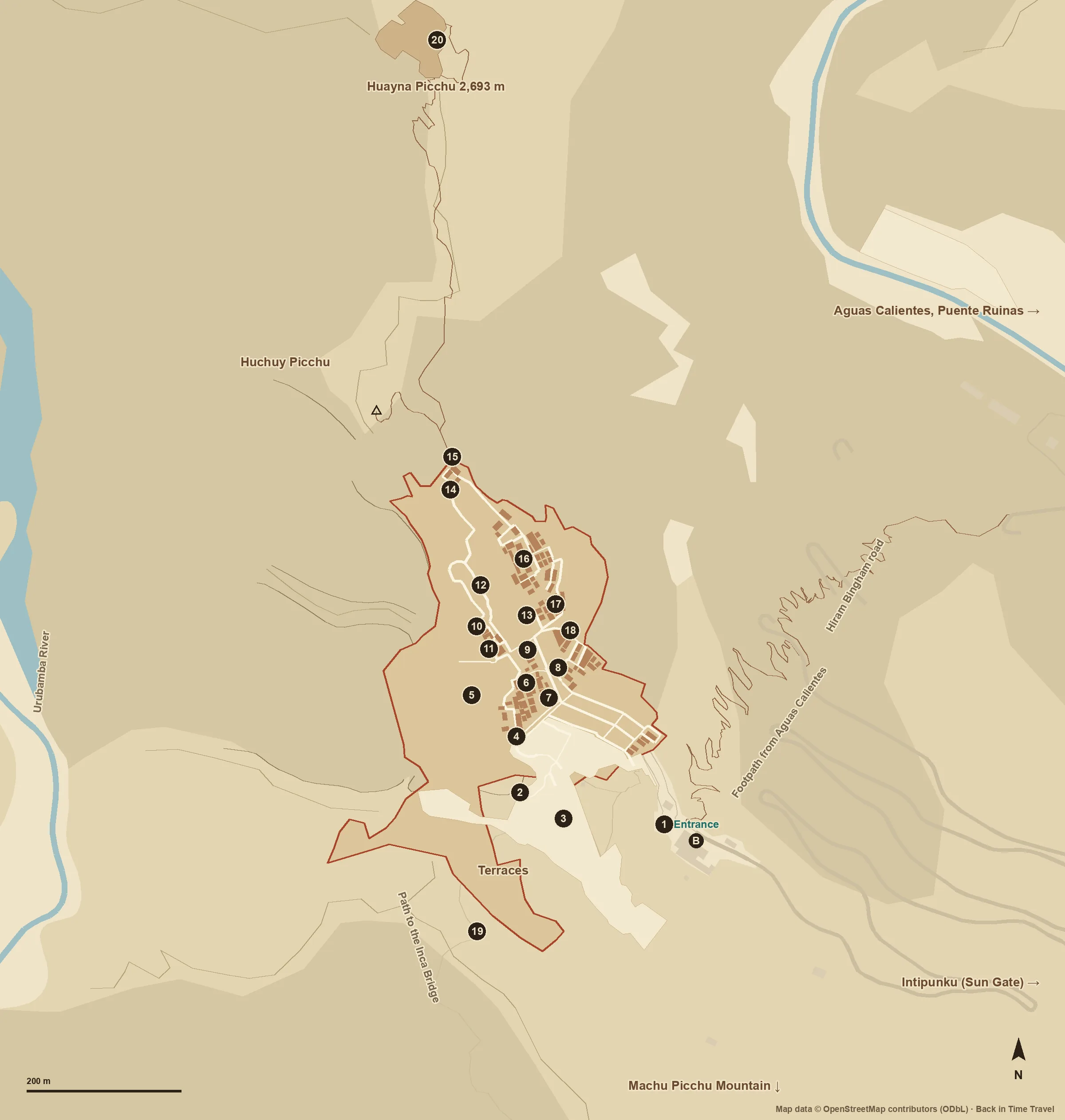
Machu Picchu stands at 2,430 metres on a ridge above the Urubamba, where the Andes give way to the cloud forest of the Amazon basin. About 200 structures occupy the ridge, divided into an agricultural sector of terraces and an urban sector with temples, houses and workshops. Built in the fifteenth century, the site was abandoned after the Spanish conquest and became known to the world beyond the valley only in 1911. Since 1983 the Historic Sanctuary, 32,592 hectares, has been a mixed cultural and natural UNESCO World Heritage property. Source: UNESCO · Historic Sanctuary of Machu Picchu

Through the centuries

No place
stands still.

Choose a period. See how the story changes over time.

01c. 1420–1450Estate

Pachacuti builds on the ridge.

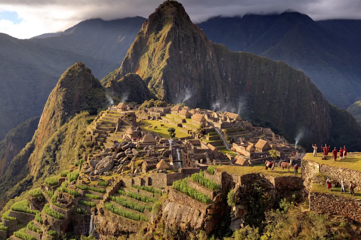
A document of 1568, published by John Rowe in 1990, names the lands of Picchu as the property of Inca Yupanqui, that is Pachacuti, the ruler who turned the Inca state into an empire. Machu Picchu was therefore a royal estate: a place for the court, its guests and the administration of the valleys. New radiocarbon dates on bone from the burials put its use at about 1420 to 1532, two decades earlier than Pachacuti’s accession, which the chronicles set at 1438. Stand here in 1450 and you see a building site that is already inhabited.

Source: Burger, Salazar, Nesbitt, Washburn & Fehren-Schmitz · New AMS dates for Machu Picchu: results and implications, Antiquity 95 (2021)
021532–1533Conquest

Cusco falls, the estate loses its lord.

In 1532 the Spaniards captured Atahualpa at Cajamarca; in November 1533 they entered Cusco. Machu Picchu belonged to Pachacuti’s lineage; with the end of the court ended the deliveries and services that fed a town on a ridge. Excavators found no traces of violence or fire, but hardly any gold or silver either: the place was cleared, not destroyed. The radiocarbon dates of the burials end around 1532.

Source: Salazar et al. · Insights into the genetic histories and lifeways of Machu Picchu’s occupants, Science Advances 9 (2023)
031537–1572Vilcabamba

The empire in the cloud forest.

After Manco Inca’s revolt in 1536 the Inca court withdrew to Vilcabamba, deeper in the cloud forest beyond the Urubamba. A state of its own survived there until 1572, when the Spaniards captured Túpac Amaru and executed him in Cusco. Machu Picchu lay at the edge of that world but is mentioned in no account of the campaigns. That is why Bingham took it in 1911 for the lost capital Vilcabamba; today we know that capital lay at Espíritu Pampa.

Source: John H. Rowe · Machu Picchu a la luz de documentos del siglo XVI, Histórica 14 (1990)
0424 July 1911Bingham

A farmer leads the professor up.

Hiram Bingham, a Yale historian, was searching the Urubamba valley for the last Inca capital. The farmer Melchor Arteaga, at whose place he stayed at Mandor Pampa, led him and Sergeant Carrasco on 24 July across a log bridge and up the slope. At the top the Richarte and Alvarez families were farming the old terraces; the boy Pablito Alvarez showed Bingham the buildings. In the Temple of the Three Windows a name was written in charcoal: Agustín Lizárraga, 1902. Machu Picchu was familiar to the people of the valley; Bingham made it known to the world.

Source: Hiram Bingham · Lost City of the Incas. The Story of Machu Picchu and its Builders (1948; Archive.org)
051912–1915Yale

Clear, survey, ship.

In 1912 Bingham returned with an expedition of Yale and the National Geographic Society. The team cleared the ruins, surveyed them and opened about a hundred burial caves on the slopes; a third journey followed in 1914/15. In April 1913 the magazine devoted an entire issue to the enterprise, making Machu Picchu the image of the Inca empire. Thousands of finds, pottery, metal, bones, went to New Haven on loan with the permission of the Peruvian government. Only after a century and a lawsuit by Peru did they return to Cusco in 2011 and 2012, to the Casa Concha.

Source: Hiram Bingham · In the Wonderland of Peru, National Geographic Magazine, April 1913 (Archive.org)
061934–1948Access

A road of hairpins and a book.

From 1934 Peruvian archaeologists around Luis Valcárcel continued clearing the site; in 1940/41 Paul Fejos worked in the surroundings and found Wiñay Wayna. In 1948 the switchback road from the railway station to the ruins was opened, and Bingham himself came to the inauguration; it bears his name. The same year his book Lost City of the Incas appeared, spreading the reading of the site as Tampu Tocco, birthplace of the Incas, and as a refuge of the Virgins of the Sun. Both readings are now rejected.

Source: Hiram Bingham · Lost City of the Incas. The Story of Machu Picchu and its Builders (1948; Archive.org)
071981–1983World Heritage

Sanctuary and mixed heritage.

In 1981 Peru declared 32,592 hectares around the ruins the Historic Sanctuary of Machupicchu, mountain forest and buildings together. In 1983 UNESCO inscribed the area as number 274 on the World Heritage List, as a mixed cultural and natural property under criteria i, iii, vii and ix: a masterpiece of Inca architecture and at the same time a transition zone between the high Andes and the Amazon with many endemic species. Since then its management has been a dispute over visitor numbers, hotel plans and landslides, with UNESCO more than once threatening the Danger List.

Source: UNESCO · Historic Sanctuary of Machu Picchu
082007 to todayVisitor circuits

Three circuits, one daily cap.

In 2007 an internet vote made Machu Picchu one of the New7Wonders; visitor numbers afterwards rose above a million a year. Since 1 June 2024 a system of three circuits with ten routes applies: Circuit 1 leads to the viewing terraces, Circuit 2 through the classic town, Circuit 3 into the lower sector and up Huayna Picchu. For 2026 the Ministry of Culture has set 4,500 tickets a day, 5,600 in high season. They are sold only through tuboleto.cultura.pe, for fixed entry times.

Source: Ministerio de Cultura del Perú · Circuitos y Rutas de Visita
Swipe or scroll

Look closer

Stone without mortar, water without a pump.

The terraces are more than fields: they hold the ridge, layer on layer of stone, gravel and soil, and drain the rain, which here reaches almost two metres a year. A channel carries spring water through sixteen basins from the Temple of the Sun down to the residential quarters. The temples are built of granite blocks ground so precisely that no mortar was needed; the Temple of the Sun wraps around a boulder, the Temple of the Three Windows opens towards the valley, and the Intihuatana is a stone carved from bedrock at the highest point of the town. The houses, by contrast, were of rubble masonry, plastered and thatched.

Source: UNESCO · Historic Sanctuary of Machu Picchu
What the evidence cannot show
What the Intihuatana actually was, sundial, altar or image of the mountain, is not documented. The name is modern, and the reading as “the stone that ties up the sun” dates from the nineteenth century.
What to look for on a visit
Compare the masonry: the blocks of the Temple of the Sun and the main plaza are ground and set without a joint, the craftsmen’s houses are of roughly dressed stone. The same town, two ranks. And look at the terraces below the guardhouse: that is where the families who showed Bingham the way were living in 1911.
Source: Hiram Bingham · Lost City of the Incas. The Story of Machu Picchu and its Builders (1948; Archive.org)

Reading the place

Beneath the surface.

Buildings and finds reveal more when we consider their context. These close readings connect the evidence with questions to take on a visit.

01

Who lived on the ridge?

Bingham’s expeditions opened about a hundred burial caves on the slopes and recovered the remains of some 170 people. In 2009 Turner and colleagues compared oxygen, strontium and lead isotopes in teeth and bone: the values scattered widely, the people had grown up in very different places and come to Machu Picchu only later. In 2023 a study in Science Advances produced genome-wide data for 34 of the buried: their origins stretch from the coast across the highlands into the Amazon lowlands, many had ancestors from several regions, and they were buried side by side.

Evidence / source: Salazar et al. · Insights into the genetic histories and lifeways of Machu Picchu’s occupants, Science Advances 9 (2023)

This matches the yanacona of the chronicles, retainers whom the court drew from across the empire and bound to its estates. The people in the graves were not the lords of the place but those who kept it running: gardeners, craftsmen, cooks, guards. The court itself came and went with the seasons.

What the evidence cannot establish on its own

The graves lie on the slopes, not in the town; the elite were probably buried in Cusco. How many people lived here at once is an estimate from the number of houses, usually given as a few hundred up to 750.

02

When was it built: 1438 or 1420?

The chronicles have Pachacuti take the throne in 1438; the dating of Machu Picchu to the years around 1450 rested on that. In 2021 Burger, Salazar and colleagues published 26 AMS radiocarbon dates on bone and teeth from four cemeteries: use of the site begins around 1420 and ends around 1532. A Polish-Peruvian project reached a similar result with dates from Machu Picchu and the neighbouring sites of Chachabamba and Choquesuysuy.

Evidence / source: Burger, Salazar, Nesbitt, Washburn & Fehren-Schmitz · New AMS dates for Machu Picchu: results and implications, Antiquity 95 (2021)

Twenty years sound like little but shift the history of the empire: either Pachacuti came to power earlier than the chroniclers write, or the expansion into the Urubamba valley began under his predecessor. Here the dates from the ground weigh more than the years Spanish authors noted a century later from oral tradition.

What the evidence cannot establish on its own

Radiocarbon dates from the fifteenth century have ranges of several decades because of the calibration curve; “around 1420” is a model value, not a construction year.

03

Estate or sanctuary?

Bingham saw in Machu Picchu in turn the Vilcabamba of the last Incas, the origin place Tampu Tocco and a convent of the Virgins of the Sun; the last reading he based on a supposed majority of female skeletons. In 1990 John Rowe showed from a 1568 file in Cusco that the lands of Picchu belonged to Pachacuti. Re-examination of the skeletons found a balanced sex ratio, and the buildings, guest houses, baths, a walled-off royal sector, resemble other royal estates such as Pisac and Ollantaytambo.

Evidence / source: John H. Rowe · Machu Picchu a la luz de documentos del siglo XVI, Histórica 14 (1990)

Estate does not mean secular: the Temple of the Sun, the Intihuatana and the alignment of several buildings on the solstices show that cult was part of the operation. The difference lies in the owner. A sanctuary belongs to a god, an estate to a lineage that kept farming it after the ruler’s death.

What the evidence cannot establish on its own

The 1568 file names lands, not the town itself. That Machu Picchu is exactly this Picchu follows from the location, not from a name on a map.

04

What was the place called?

Machu Picchu means “old mountain” and is the name of the peak above the town; Bingham took it from his guides in 1911. In 2021 Donato Amado and Brian Bauer examined land titles, court records and maps from 1588 onwards. The ruins appear there as “Huayna Picchu”, young mountain, or simply as “Picchu”, named after the pointed peak at whose foot they lie. Bingham himself noted in 1911 that Melchor Arteaga spoke of ruins at Huayna Picchu.

Evidence / source: Amado Gonzales & Bauer · The Ancient Inca Town Named Huayna Picchu, Ñawpa Pacha 42 (2021)

The name under which the place became famous is probably a twentieth-century shift. That changes nothing about the stones, but it is a reminder of how much of what counts as certain comes from the notes of a single traveller.

What the evidence cannot establish on its own

The documents are colonial; an Inca name from before 1533 has not survived. “Huayna Picchu” too remains a reconstruction from land titles.

05

Discovered or shown?

On the day of his climb Bingham met farmers growing maize and potatoes on the terraces, and the charcoal inscription of Agustín Lizárraga from 1902. Peruvian maps named the place; tenants and treasure hunters knew it. What Bingham added was the survey, the photography and the publication. The finds his expeditions took to Yale on loan with Peru’s permission stayed there for almost a hundred years; after a lawsuit by Peru in 2008 the two sides agreed in 2010, and in 2011 and 2012 the objects returned to Cusco, where Yale and the University of San Antonio Abad care for them jointly.

Evidence / source: Yale News · Peru-Yale Partnership for the Future of Machu Picchu Artifacts (2015)

The return has shifted the picture: Machu Picchu is now told less as the discovery of an American and more as a place that was never lost to its neighbours. At the Casa Concha in Cusco you see the returned pieces; at the ruins, the terraces where families lived in 1911.

What the evidence cannot establish on its own

Who first entered the ruins after the Incas cannot be established; the names Lizárraga, Arteaga, Richarte and Alvarez are only the ones Bingham wrote down.

Plan a visit

Choose the circuit before the ticket.

Tickets are sold only through tuboleto.cultura.pe, for one circuit and one entry time; in high season from June to October they sell out weeks ahead. From Cusco you take the train via Ollantaytambo to Aguas Calientes, then the bus up the switchbacks. Allow two to three hours on the circuit; going back within the site is not permitted.

Huayna Picchu, Machu Picchu Mountain and the Inca Bridge are separate routes with small quotas; the routes to the Sun Gate and the bridge open only in high season. The daily caps and prices are set anew each year by the Ministry of Culture; check the current rules before booking.

Affiliate link: we may receive a commission when you book through GetYourGuide. The historical interpretation remains independent.

Visiting sources checked on 24 September 2026. Prices and availability are provided by the operator.

Keep exploring

More of
Machu Picchu.

Sources and context

These texts combine published research with editorial explanation. Some dates are approximate. Photographs show documented surviving conditions. Specialist archaeological review is still pending.

  1. Source: UNESCO · Historic Sanctuary of Machu Picchu
  2. Source: Burger, Salazar, Nesbitt, Washburn & Fehren-Schmitz · New AMS dates for Machu Picchu: results and implications, Antiquity 95 (2021)
  3. Source: Salazar et al. · Insights into the genetic histories and lifeways of Machu Picchu’s occupants, Science Advances 9 (2023)
  4. Source: John H. Rowe · Machu Picchu a la luz de documentos del siglo XVI, Histórica 14 (1990)
  5. Source: Hiram Bingham · Lost City of the Incas. The Story of Machu Picchu and its Builders (1948; Archive.org)
  6. Source: Hiram Bingham · In the Wonderland of Peru, National Geographic Magazine, April 1913 (Archive.org)
  7. Source: Ministerio de Cultura del Perú · Circuitos y Rutas de Visita
  8. Source: Ministerio de Cultura del Perú · Tu Boleto (amtlicher Ticketverkauf)
Images and usage rights

Machu Picchu from the upper terraces near the Guardian’s Hut: the main plaza with its single tree, the temple sector on the left, the residential quarters on the right, Huayna Picchu behind. Photograph taken on 27 June 2009 in evening light. Martin St-Amant (S23678) / Wikimedia Commons · CC BY-SA 3.0. Cropped to 3:2 (sky trimmed at the top), resized to 1600 pixels wide and compressed as WebP; no content alterations. Framing varies by screen. Derived photograph under the same licence.

Barlow OFL · Manrope OFL