Ephesus Map: Plan of the Ruins
Our own plan of Ephesus with 16 highlights, the upper and lower gates, the Terrace Houses, the Library of Celsus and the theatre. Tap a number for details, choose a route or print the map for your visit.
Map of the ruins of Ephesus
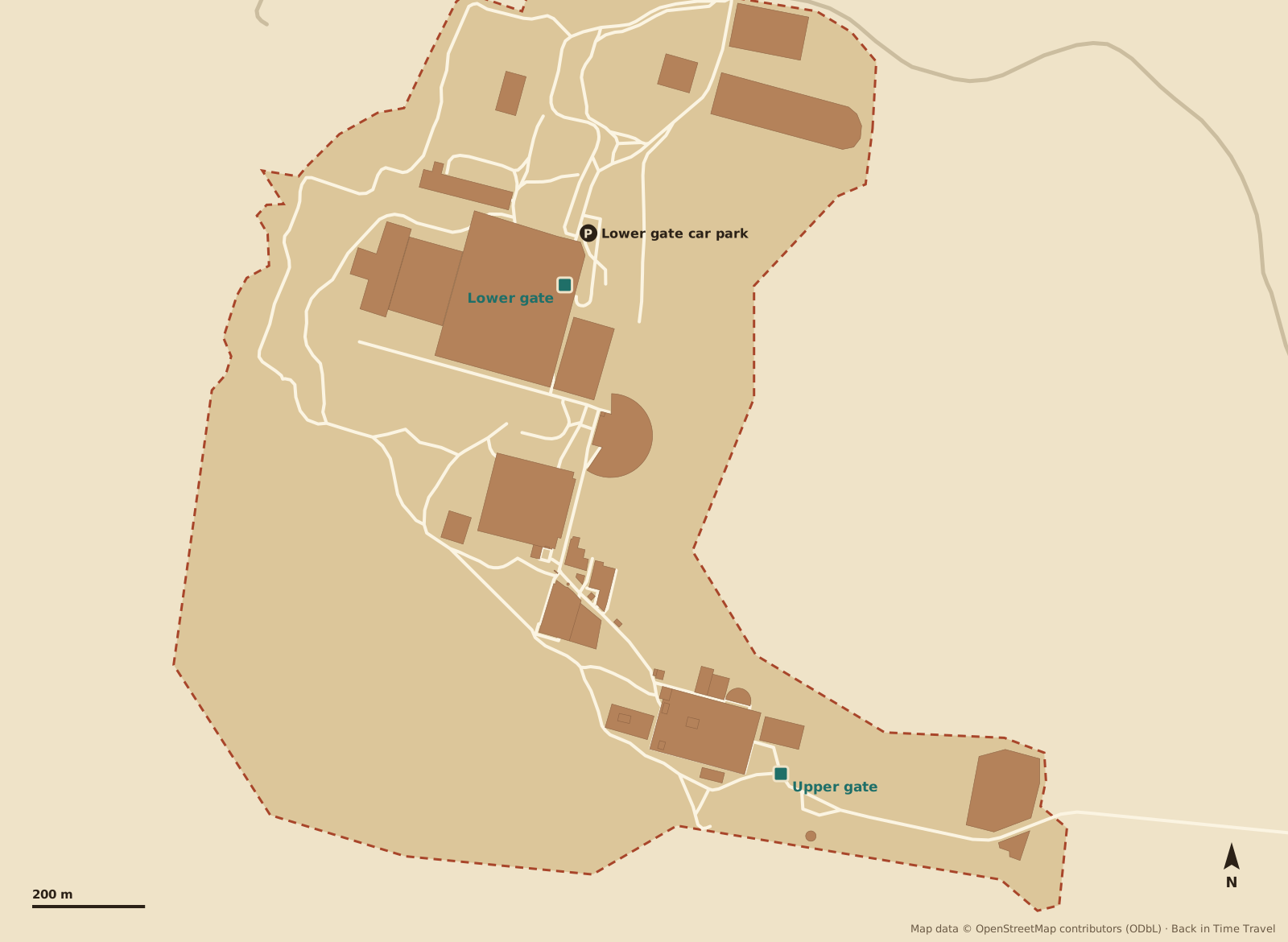
Map data © OpenStreetMap contributors, ODbL. Drawn by Back in Time Travel, data as of 25 September 2026. The map is a guide; paths and open areas can change.
The 16 highlights on the map
The numbers match the map. The order follows the walk downhill from the upper gate to the lower gate.
Upper gate Entrance
The entrance in the south-east, on the road to the House of the Virgin Mary. Start here and you walk the whole city downhill.
Read more →State Agora Square
The administrative square of the Roman city, 160 by 56 metres, with basilica and temple. Today a wide open space with column remains.
Odeion Council house
The small theatre for 1,500 people, around 150 AD, seat of the city council and concert hall. Once roofed.
Prytaneion Town hall
The sacred fire of the city burned here. Two statues of Artemis of Ephesus were found here; they are in the museum in Selçuk.
Temple of Domitian Temple
The city’s first imperial temple, around 90 AD. After Domitian’s death it was rededicated to Vespasian.
Gate of Hercules Gate
Two pillars with the lion skin of Hercules mark the start of Curetes Street. From here on, pedestrians only.
Fountain of Trajan Fountain
A two-storey monumental fountain of about 110 AD; the emperor’s statue in the centre stood with one foot on the globe.
Temple of Hadrian Temple
The small temple with the famous arch and the Medusa in the pediment, around 130 AD. The reliefs are copies; the originals are in the museum.
Terrace House 2 Houses
Seven homes of wealthy Ephesians under a protective roof, with mosaics, wall paintings and underfloor heating. Separate ticket, €15.
Read more →Latrine Toilets
The public toilet next to the Baths of Scholastikia: marble seats in a row, running water underneath, chatting welcome.
Library of Celsus Library
The landmark: the facade of the library of 117 AD, re-erected in 1970 to 1978, and also the tomb of Celsus. Our time journey starts here.
Tetragonos Agora Market
The commercial market of the city, 110 by 110 metres, surrounded by colonnades. Reached through the Gate of Mazaeus and Mithridates next to the library.
Great Theatre Theatre
The theatre for 25,000 people on the slope of Mount Panayır. According to the Acts of the Apostles, the silversmiths rioted here against Paul.
Read more →Harbour Baths and Arcadiane Harbour Street
The 530-metre colonnaded street from the theatre to the ancient harbour, lit at night. The sea is now six kilometres away.
Read more →Church of Mary Church
The double church where the Council of Ephesus met in 431. Converted from a Roman hall.
Lower gate and Experience Museum Entrance
The second entrance by the theatre. The Experience Museum (included in the ticket) shows the city as an immersive projection.
Read more →
Routes through Ephesus
Three suggestions, all downhill from the upper gate. Choose a route and its stops are highlighted on the map.
2 hours: the classics
From the upper gate along Curetes Street to the Library of Celsus and the theatre, exit at the lower gate.
3 hours: with the Terrace Houses
The classics, plus the Terrace Houses with their mosaics and wall paintings (separate ticket).
Half a day: the whole city
Everything from the long route, plus the State Agora, Harbour Baths and Church of Mary, ending at the Experience Museum.
The two gates
- Upper gate (Magnesian Gate)
- In the south-east on the road to the House of the Virgin Mary. From here you walk downhill through the whole city: the easier way, which most guided tours take.
- Lower gate
- In the north-west by the theatre and the Experience Museum, closer to Selçuk. From here the path climbs to the library and Curetes Street.
- Parking
- Both gates have paid car parks; taxis shuttle between the gates so you do not have to walk back.
Prices, opening hours and whether the Terrace Houses are worth it are in our guide Ephesus tickets and admission.
Where is Ephesus?
Ephesus lies on the west coast of Türkiye, three kilometres south-west of the small town of Selçuk in İzmir province. The sea, once right at the city’s harbour, is now about six kilometres away. Distances from the ruins, as the crow flies:
- Selçuk
- 3 km
- Kuşadası (port)
- 11 km
- İzmir
- 57 km
- Pamukkale
- 156 km
- Bodrum
- 101 km
Frequently asked questions about the Ephesus map
Where is Ephesus?
Ephesus lies on the Turkish Aegean coast in İzmir province, about 2.7 kilometres south-west of Selçuk, 11 kilometres from the cruise port of Kuşadası and 57 kilometres from İzmir. Selçuk station is on the İzmir–Denizli line.
How big is Ephesus?
The excavated city stretches about two kilometres from the upper to the lower gate, with about 100 metres of height difference. The highlights take two to three hours, with the Terrace Houses and museum half a day.
Is there a printable Ephesus map?
Yes: use the “Print map or save as PDF” button on this page. It prints the map, the highlights and the routes. There are also information boards at the gates.
Which Ephesus gate is the best start?
The upper gate. From there the path runs downhill through the whole city to the library and the theatre, and you leave at the lower gate. A taxi back to your car costs a few euros. Visitors from Kuşadası port are usually dropped at the upper gate.
Are the Terrace Houses worth it?
Yes, if Roman living interests you: mosaics, wall paintings and underfloor heating under a protective roof, often almost empty. They cost €15 extra and are right on Curetes Street.
Where is the Temple of Artemis?
Not in the excavation but two kilometres north-east on the edge of Selçuk: a single re-erected column in a marshy field, free to visit. Nothing else of the wonder of the world remains to be seen.