Athens · Greece · Attica
Acropolis.
The rock above Athens.
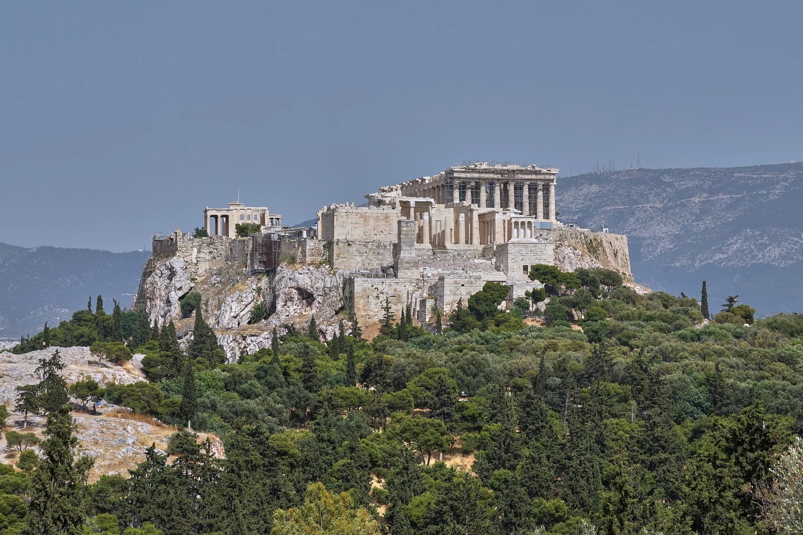
A limestone rock 156 metres high, and on it the buildings of the 5th century BC: Parthenon, Erechtheion, Propylaea and the Temple of Athena Nike. The Acropolis is the most visited monument in Greece. Here is everything for your trip: the history of the rock up to the explosion of 1687, tickets and time slots, and our own map with both entrances.
The Parthenon was a temple, a church and a mosque, then in 1687 a gunpowder store, until a Venetian cannonball blew it apart. What stands today is the result of 2,500 years of use and 50 years of restoration. The Acropolis has been a UNESCO World Heritage Site since 1987. Source: UNESCO
Three ways up the rock
Understand, plan,
find your way
01Real photo447 BCThe historyFrom the building programme of Pericles to the church inside the Parthenon and the explosion of 1687.Read the history 02Checked 25 Sep 20262026Tickets & time slots€30 all year, how to book a slot, free days, both entrances, getting there by metro.Plan your visit 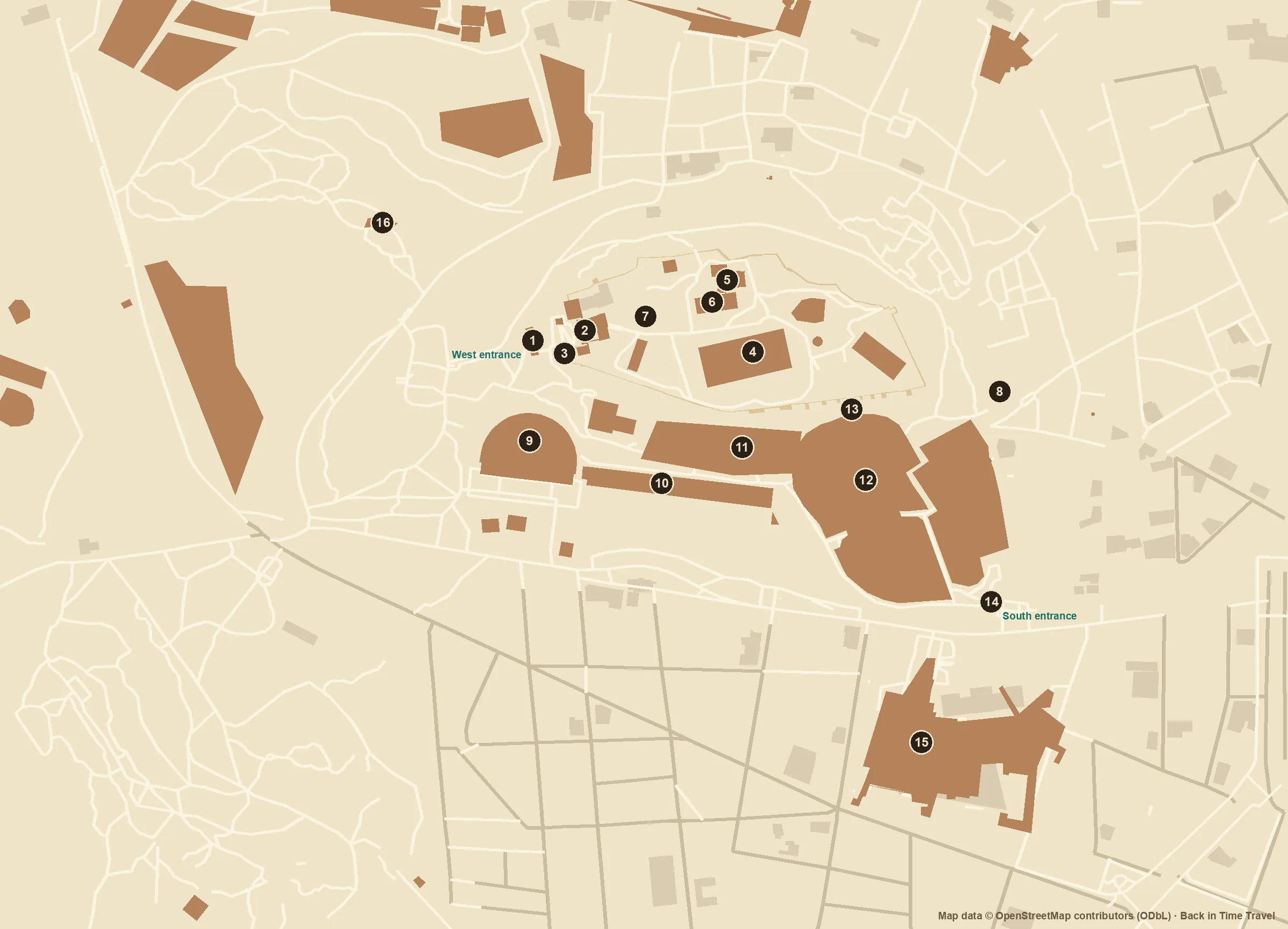 03Own plan16 sitesThe mapPlan of the rock with highlights, south slope, entrances, museum and metro.Open the map
 The Acropolis in brief
The Acropolis in brief
Where is the Acropolis?
In the centre of Athens, between Plaka, Monastiraki and Koukaki. Akropoli metro station is three minutes from the south entrance; Syntagma Square is a 20-minute walk.
When was the Parthenon built?
447 to 432 BC under Pericles, to plans by Iktinos and Kallikrates; Phidias directed the sculpture. The Propylaea followed in 437 to 432 BC.
What can you see today?
Parthenon, Erechtheion with the caryatids, Propylaea and the Nike temple on the rock; on the south slope the Theatre of Dionysus and the Odeon of Herodes Atticus. The original sculptures are in the Acropolis Museum.
How long do you need?
One to two hours for the rock, two to three with the south slope. Half a day with the Acropolis Museum. Our map has routes for all three.
Looking beyond Athens
At the same
time, elsewhere.
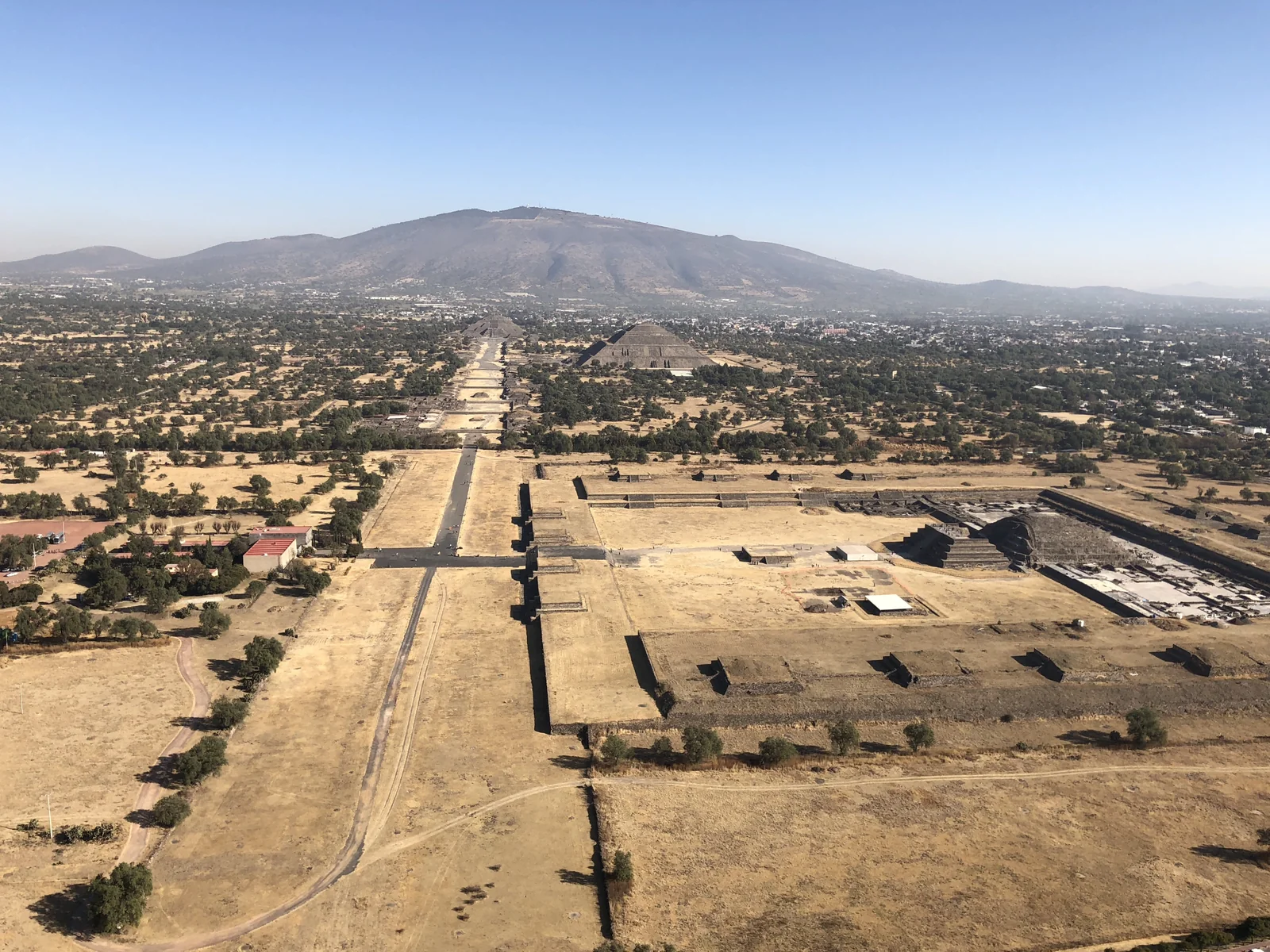
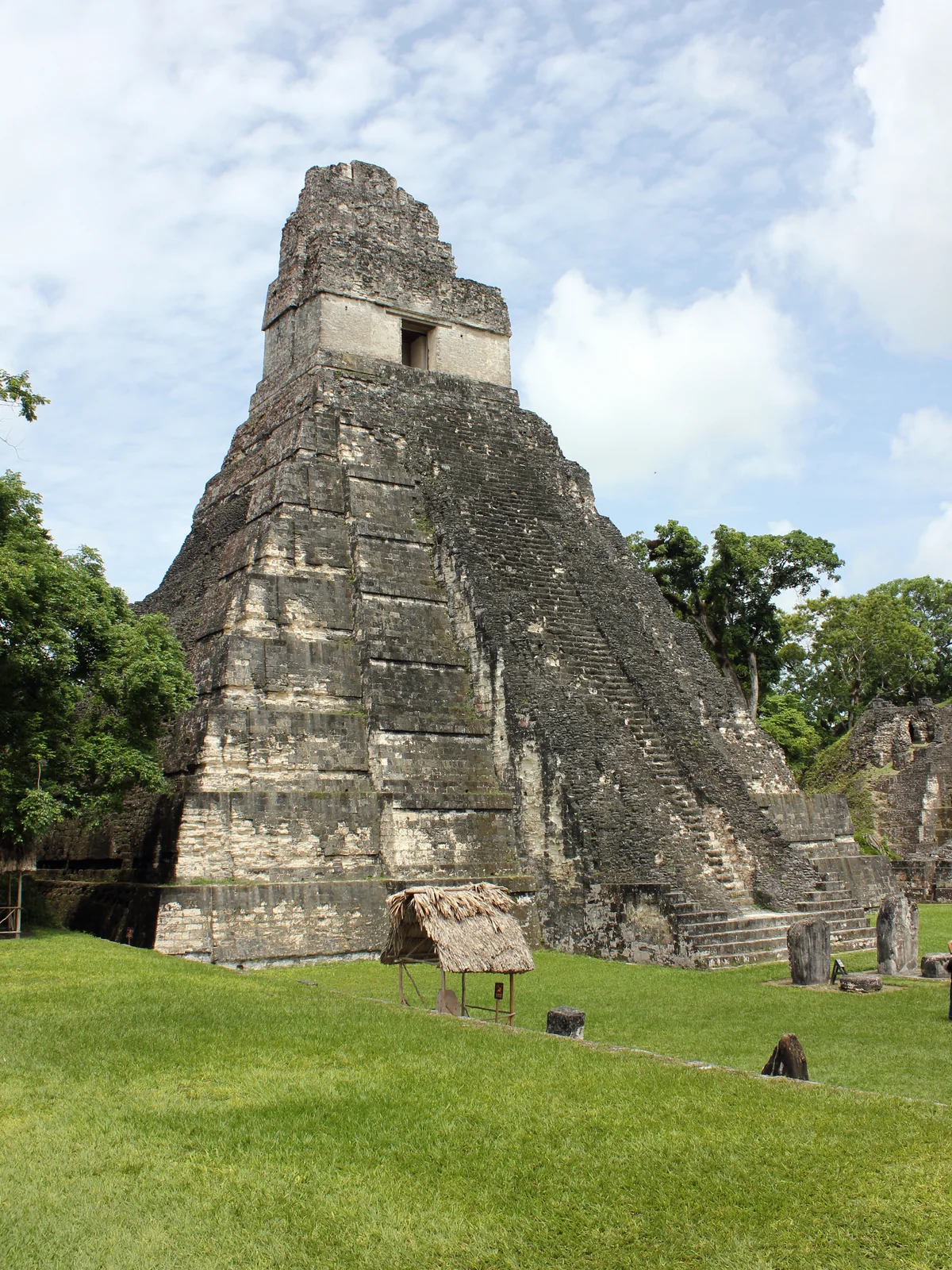
While Athens was building the Parthenon, Rome was still a regional power and Tikal a village. Drag the marker and discover five selected places.
- 100 BC – 79 AD A city still inhabited
- 600 BC – 481 BC Before the Parthenon
- 480 BC – 448 BC After the Persian destruction
- 447 BC – 433 BC A monument takes shape
- 432 BC – 399 AD The Classical ensemble
- 400 AD – 1000 AD New uses, the same rock
- 300 BC – 1 BC A Hellenistic framework
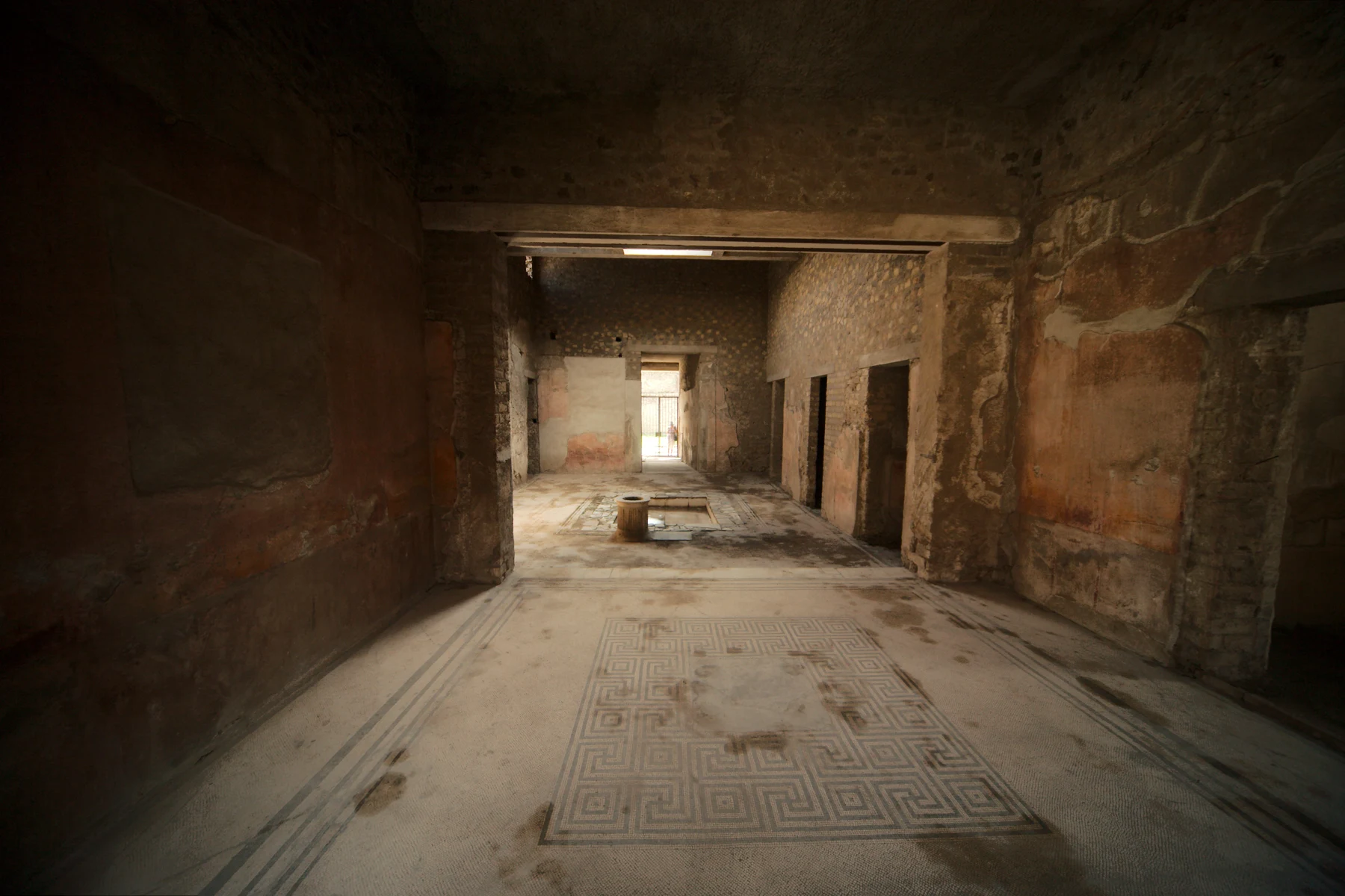
- 1 AD – 149 AD Roman living spaces
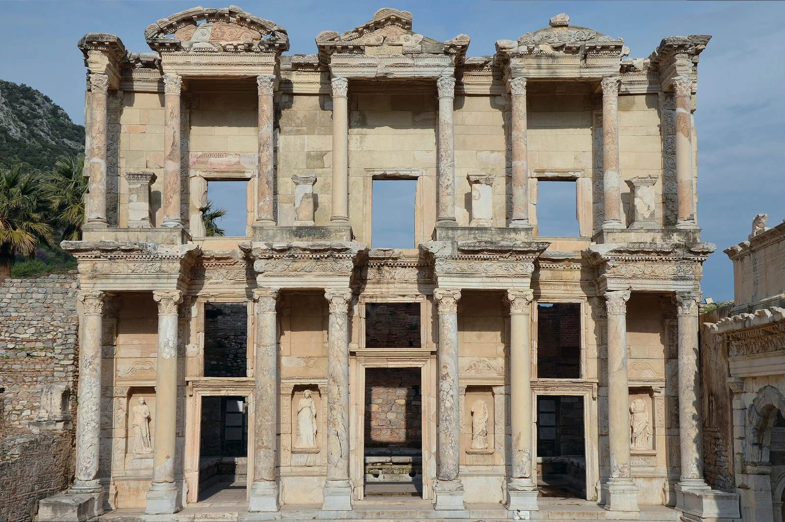
- 150 AD – 269 AD The age of the library
- 270 AD – 800 AD A building changes its role
- 1 AD – 149 AD The city grows
- 150 AD – 249 AD An axis for the city
- 250 AD – 599 AD Life between the monuments
- 600 AD – 700 AD A centre in transition
- 600 BC – 199 AD Before the great temples
- 200 AD – 694 AD A Classic Maya city
- 695 AD – 733 AD After the victory over Calakmul
- 734 AD – 799 AD Monument and memory
- 800 AD – 950 AD An urban world in transition
The bands show editorial windows from our five stories, not complete settlement histories. Window boundaries organise the narrative; not every change can be dated to a single year. Photographs show the surviving condition, not the selected year. Present-day coastlines provide orientation.
From your screen to the rock
Experience the Acropolis yourself
The Acropolis is open daily; tickets are sold online by the platform of the Greek Ministry of Culture, tied to a time slot. Guided tours put the buildings in order and tell what happened in 1687.
Affiliate link: we may receive a commission when you book through GetYourGuide. The historical interpretation remains independent.
Sources and context
This overview relies on UNESCO, the Acropolis Restoration Service and the site operator; each subpage cites its sources alongside the content.
Images and usage rights
Acropolis from the Pnyx: photo George E. Koronaios, 2020, CC BY-SA 4.0, via Wikimedia Commons. Map: own plan based on OpenStreetMap data (ODbL).
View from the Pnyx towards the Acropolis of Athens and the Parthenon, photographed on 20 May 2020. George E. Koronaios / Wikimedia Commons · CC BY-SA 4.0. Resized to 1600 pixels wide and converted to WebP; no cropping or content alterations. Framing varies by screen. Derived photograph under the same licence.

The façade of the Library of Celsus in Ephesus, Turkey, photographed on 8 April 2015. Carole Raddato / Wikimedia Commons · CC BY-SA 2.0. Resized to 1600 pixels wide and converted to WebP; no cropping or content alterations. Framing varies by screen. Derived photograph under the same licence.
.jpg)
Temple I at the Great Plaza of Tikal, Guatemala. Photograph taken on 26 June 2015. Kaldari / Wikimedia Commons · CC0 1.0. Resized to a maximum edge of 1600 pixels and compressed as WebP; no crop or content alterations. Framing varies by screen. Derived photograph under the same licence.

View across the Avenue of the Dead at Teotihuacan: the Pyramid of the Sun stands to the right, with the Pyramid of the Moon at the far end of the axis. Photograph taken on 27 December 2017. Ralibreros112 / Wikimedia Commons · CC BY-SA 4.0. Resized to a maximum edge of 1600 pixels and compressed as WebP; no crop or content alterations. Framing varies by screen. Derived photograph under the same licence.

Natural Earth / world-atlas · Licences