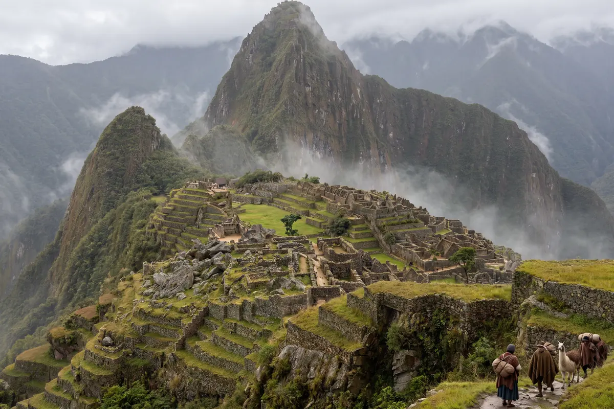
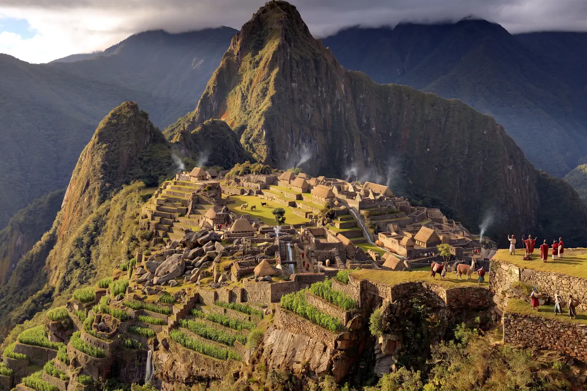
AI vision: Machu Picchu around 1450 as a living town, every house with a steep thatched roof, pale plastered walls, terraces planted with maize and potatoes, llamas on the main plaza, water running in the channels, Huayna Picchu behind
AI vision: Machu Picchu in 1572, the town abandoned, thatched roofs collapsed or mossy, terraces overgrown, mist in the valley, first trees in the courtyards, a small party with loads on the path down
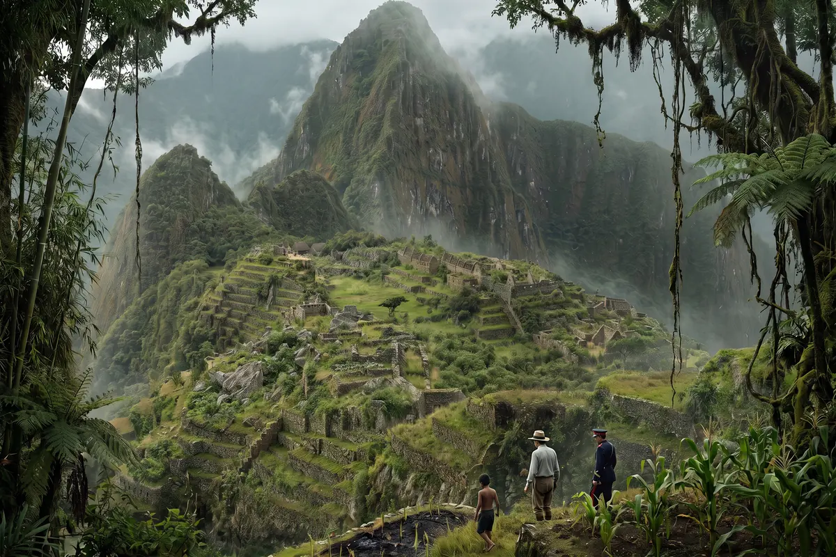
AI vision: Machu Picchu on 24 July 1911 almost entirely under forest, bamboo and vines, only wall edges and terraces showing through the mist, three tiny figures: Hiram Bingham with a hat, Sergeant Carrasco in uniform and the boy Pablito
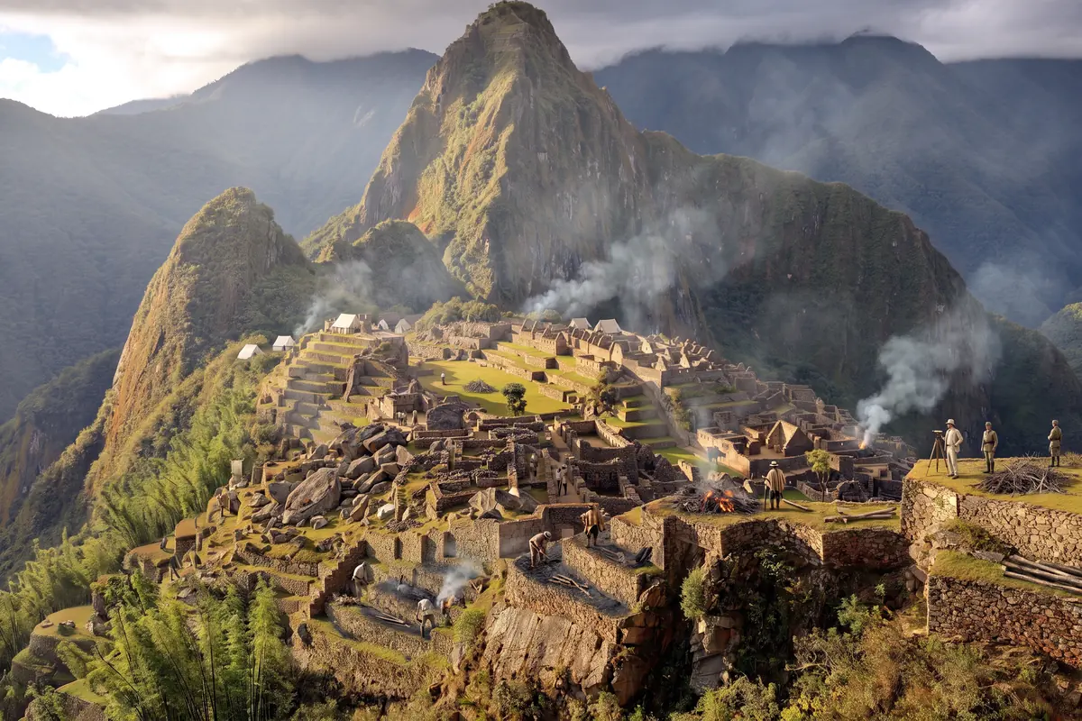
AI vision: Machu Picchu in 1912 during the clearing by the Yale Peruvian Expedition, workers cutting and burning scrub, columns of smoke over the terraces, tents, uncovered walls between half-cleared forest, a surveying instrument
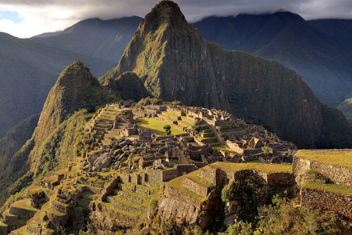
Machu Picchu today from the upper terraces by the Guardhouse: the town with the main plaza, the temple district on the left, the residential quarter on the right, Huayna Picchu behind (photo)
Documented Main plaza with lawn: location documented, its use as a plaza tooDocumented Terraces with maize and potatoes: agricultural sector, cultivation documentedDocumented Temple district with the Intihuatana hill: buildings surviving, roofs reconstructedAssumed Thatched roofs and pale plaster: roof form documented, colour guessedInvented Llamas, inhabitants, the priest at the Intihuatana
Documented Main plaza and buildings without roofs: no roof survives, use ends around 1532Documented Residential quarter with open gables: the gable walls still stand todayAssumed First trees and moss in the courtyards: Bingham found forest in 1911, the beginning is an estimateAssumed Overgrown terraces: state before 1911 documented, assumed for 1572Invented The party with loads on the path
Documented Town under forest: Bingham describes trees, moss, bamboo and vines over the wallsDocumented Temple district: the Temple of the Three Windows with Lizárraga’s charcoal inscription of 1902Documented Burned-off terraces: Richarte and Alvarez had farmed here for four yearsAssumed Mist and rain: Bingham describes a wet, cold morningInvented Bingham, Carrasco and the boy at this spot
Documented Plaza and walls uncovered: the clearing of 1912 is documented in photographsDocumented Residential quarter with open gables: Bingham’s photos of 1912 show them like thisDocumented Terraces cleared: the farmers had already burned here before 1911Assumed Smoke and fire in the scrub: Bingham describes the burning, place and extent estimatedInvented Tents, surveying instrument, workers in the foreground
Documented Main plaza and town: about 200 buildings, World Heritage since 1983Documented Huayna Picchu: according to Amado and Bauer the original name of the townDocumented Terraces by the Guardhouse: the viewpoint of this time journey, on circuits 1 and 2

AI vision · artistic licence

The rediscovery of Machu Picchu: one view, 575 years

You stand in a single spot, on the upper terraces by the Guardhouse, looking across the town to Huayna Picchu. Time runs, you don’t. Scroll from the estate of the Inca around 1450 through the abandoned town of 1572, the morning Bingham stood in the bamboo in 1911 and the fire of the clearing to the view that awaits you today.

I’m Ada Falk. I have spent my life digging through dirt in search of other lives. On this ridge people from everywhere worked for an Inca, and then for three hundred years nobody did. I’ll show you who they were and who found them again. I’ll guide you.

Ada is an invented narrator. The history is real: every fact and quotation is sourced, and the sources are listed at the end. The images are AI visions, not scientific reconstructions. The button “What is the evidence?” shows what is documented.

AI vision: Machu Picchu around 1450 as a living town, every house with a steep thatched roof, pale plastered walls, terraces planted with maize and potatoes, llamas on the main plaza, water running in the channels, Huayna Picchu behind

Diary 1 / 5 · around 1450 · a morning in the dry season

Machu Picchu in the time of Pachacuti around 1450: The estate of the Inca

Stand here, on the top terrace by the Guardhouse, and look north. What you see below is not a ruin but an estate: every house carries a steep roof of ichu grass, the walls are plastered pale, water runs in the channels from the spring to the sixteen fountains, and maize and potatoes stand in rows on the terraces. Llamas graze on the plaza. The Inca Pachacuti built this ridge for himself, as a country seat for his family, two days from Cusco.

The people who work here come from everywhere: the highlands, the coast, the Amazon lowlands. We have known that since 2023 from their bones, not from books. The radiocarbon dates say people lived here by about 1420, earlier than the chroniclers allow for Pachacuti’s rise. The roofs, the water and the terraces are documented; the colour of the plaster, the llamas on the plaza and the priest at the Intihuatana are my invention.

The archaeologists, 2021

„The results indicate that the site was occupied from c. AD 1420–1532, and that activity began there two decades earlier than suggested by the textual sources that associate the site with Emperor Pachacuti’s rise to power in AD 1438.“

R. L. Burger et al.: New AMS dates for Machu Picchu. Antiquity 95 (2021).

Image: AI vision based on a photo by Martin St-Amant (CC BY-SA 3.0), not a scientific reconstruction.

AI vision: Machu Picchu in 1572, the town abandoned, thatched roofs collapsed or mossy, terraces overgrown, mist in the valley, first trees in the courtyards, a small party with loads on the path down

Diary 2 / 5 · 1572 · a day in the rainy season

Machu Picchu abandoned, 1572: The roofs fall

A hundred years later the estate is empty. The Spaniards have been in Cusco since 1533, Pachacuti’s descendants gave up their country seat bit by bit; the radiocarbon dates end around 1532. No Spaniard ever set foot on this ridge, as far as we know, and so nothing here was destroyed: the town decays on its own. Grass roofs last a few years without care, then they sag and fall, and in the courtyards the first trees take root.

Down in the valley, at Vilcabamba, a last Inca state holds out. In 1572 the Spaniards take it and execute Túpac Amaru in Cusco. The party in the picture carrying loads down the path is my invention: someone must have been the last, but nobody wrote it down. The fallen roofs and the overgrown terraces are what Bingham found in 1911, only three hundred years earlier.

The geneticists, 2023

„The retainer population at Machu Picchu was highly heterogeneous with individuals exhibiting genetic ancestries associated with groups from throughout the Inca Empire and Amazonia, suggesting a diverse retainer community in which people of different genetic backgrounds lived, reproduced, and were interred together.“

L. C. Salazar et al.: Insights into the genetic histories and lifeways of Machu Picchu’s occupants. Science Advances 9 (2023).

Image: AI vision based on a photo by Martin St-Amant (CC BY-SA 3.0), not a scientific reconstruction.

AI vision: Machu Picchu on 24 July 1911 almost entirely under forest, bamboo and vines, only wall edges and terraces showing through the mist, three tiny figures: Hiram Bingham with a hat, Sergeant Carrasco in uniform and the boy Pablito

Diary 3 / 5 · 24 July 1911 · early afternoon

Bingham finds Machu Picchu, 24 July 1911: Three men in the bamboo

Three hundred and forty years of forest. On the morning of 24 July 1911 Hiram Bingham, a lecturer from Yale, climbs up from the river with Sergeant Carrasco and the tenant Melchor Arteaga, in rain, over a bridge of four logs. At the top, in a grass hut, live the farmers Richarte and Alvarez, who have burned off a few terraces and planted maize. They send a boy with him, whom Bingham only calls “a small boy”; tradition knows him as Pablito. What you see in the picture is what the boy shows him: edges of white granite under moss, bamboo and vines.

Bingham is not the first. On a wall of the Temple of the Three Windows someone has written in charcoal “A. Lizárraga 1902”, the name of a tenant farmer from the valley, and Bingham notes it in his journal the next day. The farmers have lived here for four years. But Bingham has a camera, and next year he returns with Yale and the National Geographic Society. The three figures are small because the forest is large; their position in the picture is invented.

Bingham, 1922

„Crossing these terraces, I entered the untouched forest beyond, and suddenly found myself in a maze of beautiful granite houses! They were covered with trees and moss and the growth of centuries, but in the dense shadow, hiding in bamboo thickets and tangled vines, could be seen, here and there, walls of white granite ashlars most carefully cut and exquisitely fitted together.“

Hiram Bingham: Inca Land. Explorations in the Highlands of Peru. Boston 1922, chapter XVII.

Image: AI vision based on a photo by Martin St-Amant (CC BY-SA 3.0), not a scientific reconstruction.

AI vision: Machu Picchu in 1912 during the clearing by the Yale Peruvian Expedition, workers cutting and burning scrub, columns of smoke over the terraces, tents, uncovered walls between half-cleared forest, a surveying instrument

Diary 4 / 5 · August 1912 · midday

The clearing by the Yale expedition of 1912: Fire in the forest

A year later the ridge burns. Bingham is back with the Yale Peruvian Expedition, paid for by the university and the National Geographic Society, and has the forest cut: workers from the valley, a lieutenant with soldiers, machetes, axes, fire in the sugar cane and the bamboo. Where the smoke rises, walls appear, stairways, channels, the plaza. Bingham photographs everything; in April 1913 the pictures fill an entire issue of the National Geographic and make the place world-famous within a year.

They dig too: more than a hundred graves in the caves below the terraces, pottery, bronzes, bones. The finds go to Yale, with Peru’s permission and a promise of return. It takes until 2011 for the first crates to come back to Cusco, until November 2012 for the last. The columns of smoke and the uncovered walls follow Bingham’s report; the tents, the surveying instrument and the workers at exactly this spot are invented.

Bingham, 1913

„On the first day I had set fire to the cane in order to clear the trail.“

Hiram Bingham: In the Wonderland of Peru. National Geographic Magazine, April 1913.

Image: AI vision based on a photo by Martin St-Amant (CC BY-SA 3.0), not a scientific reconstruction.

Machu Picchu today from the upper terraces by the Guardhouse: the town with the main plaza, the temple district on the left, the residential quarter on the right, Huayna Picchu behind (photo)

Diary 5 / 5 · Today

Machu Picchu today: And now you

This is real. Exactly this view awaits you when you climb the steps to the Guardhouse on circuit 1 or 2: the plaza below, the temple district with the Intihuatana on the left, the gables of the houses on the right, and behind them Huayna Picchu, which according to the records of the 16th century was probably the real name of the town. Two hundred buildings at 2,430 metres, World Heritage since 1983, not a roof left, but every stairway in its place.

The finds from Bingham’s crates have been at Casa Concha in Cusco since 2011, where admission is free for the people of the city. Up here the Ministry of Culture regulates the number of visitors with fixed circuits and time slots. Stand at the Guardhouse, half close your eyes, and the roofs are back.

The historians, 2022

„The Incas originally called it Huayna Picchu, for the rocky summit that lies nearest to the site, and not Machu Picchu.“

D. Amado Gonzales and B. S. Bauer: The Ancient Inca Town Named Huayna Picchu. Ñawpa Pacha 42 (2022), as quoted in the press release of the University of Illinois Chicago.

Real photo: Martin St-Amant (S23678), CC BY-SA 3.0, via Wikimedia Commons.

Your expedition

Visit Machu Picchu: Stand exactly here

“The rest you have to see for yourself. And when you stand down on the plaza, look up to the Guardhouse. That is where the boy stood when he showed Bingham the walls.” Ada Falk

  1. From the entrance to the Guardhouse. On circuit 1 or 2 the steps lead straight up from the entrance to the upper terraces. At the Guardhouse the view opens over the whole town to Huayna Picchu: that is the view of this time journey.
  2. Down into the town. Through the town gate to the temple district with the Temple of the Three Windows, where Lizárraga left his name in 1902, up to the Intihuatana, then across the plaza to the residential quarter.
  3. Then the finds. Back in Cusco, Casa Concha, where the objects from Bingham’s crates have been kept since 2011.
  • From 6 am: In the first time slot the mist rises from the valley and the Guardhouse is still empty; from 9 am the groups from Aguas Calientes arrive.
  • Check the circuit: Not every circuit leads to the Guardhouse; tickets per time slot are limited, so book weeks ahead in the dry season. Huayna Picchu needs a separate ticket.
  • Check first: Tickets, circuits and how to get there are in our guide to Machu Picchu tickets and admission; all highlights are on our map.

At a glance

Machu Picchu in facts

Built
around 1450 as the estate of the Inca Pachacuti; radiocarbon dates from about 1420
Location
2,430 metres above sea level on a ridge above the Urubamba, between Machu Picchu and Huayna Picchu
Size
about 200 buildings, terraces, 16 fountains; World Heritage area 32,592 hectares
Inhabitants
retainers from the whole empire, a third with Amazonian ancestry (DNA study 2023)
Abandoned
around 1532 to 1572, with the end of the Inca state of Vilcabamba; never entered by the Spaniards
Before Bingham
charcoal inscription “A. Lizárraga 1902”; farming families on the terraces from about 1907
Rediscovery
24 July 1911, Hiram Bingham with Sergeant Carrasco; clearing in 1912 by the Yale Peruvian Expedition
Today
World Heritage since 1983; finds returned from Yale to Cusco in 2011 and 2012; visits only with a circuit and a time slot

Frequently asked questions about Machu Picchu and its rediscovery

Who discovered Machu Picchu?

Nobody ever forgot it: farming families lived on the terraces, and a tenant farmer from the valley, Agustín Lizárraga, wrote his name in charcoal on the Temple of the Three Windows in 1902. Hiram Bingham of Yale University climbed up on 24 July 1911 with Sergeant Carrasco, saw the inscription and noted it. He made the place known, with photographs and a 1913 issue of the National Geographic, which is why 1911 counts as the year of the scientific rediscovery.

When was Machu Picchu built, and by whom?

Around 1450 as the estate of the Inca Pachacuti, according to the chroniclers. Radiocarbon dates published in 2021 show that people lived here by about 1420, two decades earlier than the written sources give for Pachacuti’s rise. The site was used until about 1532, the year of the Spanish conquest.

Why was Machu Picchu abandoned?

After the Spanish conquest of 1533 the Inca elite in Cusco lost their estates, and a remote ridge two days away could no longer be maintained. The Spaniards never found the place, as far as we know; that is why it was not destroyed but overgrown by forest. In 1572 the Spaniards took the last Inca state at Vilcabamba.

Who lived at Machu Picchu?

A DNA study of 2023 on 34 burials shows retainers from the whole Inca Empire, a third of them with substantial ancestry from the Amazon lowlands. They lived together, had children together and were buried side by side. The ruling family itself came only at times, in the dry season.

Is Machu Picchu really called Huayna Picchu?

Probably. In 2021 the historian Donato Amado Gonzales and the archaeologist Brian Bauer compared Bingham’s notes, an atlas of 1904 and land records of the 16th century: the Incas called the town Huayna Picchu, after the pointed peak behind it, or simply Picchu. The name Machu Picchu, “old mountain”, belongs to the ridge on the other side and was transferred to the ruins through Bingham.

Where are Bingham’s finds today?

In Cusco. The Yale expeditions of 1912 and 1914–15 took pottery, bronzes and bones from more than a hundred graves to New Haven. After decades of dispute Peru and Yale reached an agreement in 2010; the objects returned in three shipments in March 2011, December 2011 and November 2012 and are kept at the Casa Concha museum of the University of Cusco, which opened in October 2011.

What did Machu Picchu look like?

Every building carried a steep roof of ichu grass on a wooden frame, the walls were probably plastered, maize and potatoes grew on the terraces, and water ran through channels to sixteen fountains. The images on this page are AI visions meant to convey a feeling; colours, people and scenes are interpretation, and the buildings follow the evidence only in broad strokes.

When is the best time for this view?

In the first time slot from 6 am, when the mist rises from the valley and the Guardhouse is still empty, or in the late afternoon in the dry season from May to September. The view from the upper terraces is on circuits 1 and 2. Tickets, circuits and how to get there are in our guide to Machu Picchu tickets and admission.

About these images

The images of stages 1 to 4 are AI visions generated with Nano Banana Pro (Google Gemini) via fal.ai; the starting point was a photograph taken from the upper terraces by the Guardhouse (Martin St-Amant, CC BY-SA 3.0, cropped). As adaptations of that photo the visions are published under the same licence. They are meant to convey a feeling and are not scientific reconstructions: people, clothing, colours and scenes are invented, and the buildings follow the evidence only in broad strokes. The image files are labelled as AI-generated (IPTC). The last image is the unaltered photograph.

Sources and status

Text: Daniela Pieper, Back in Time Travel editorial team. Updated 25 September 2026. Specialist review is still pending. Translations are our own, abridged.

  1. Machupicchu, official site (Dirección Desconcentrada de Cultura Cusco): history
  2. Machupicchu, official site: visiting hours and circuits
  3. Ministry of Culture of Peru
  4. UNESCO World Heritage: Historic Sanctuary of Machu Picchu
  5. Hiram Bingham: Inca Land. Explorations in the Highlands of Peru (1922, Project Gutenberg)
  6. Hiram Bingham: In the Wonderland of Peru. National Geographic Magazine, April 1913 (Internet Archive)
  7. Hiram Bingham: Lost City of the Incas (1948, Internet Archive)
  8. Burger et al.: New AMS dates for Machu Picchu, Antiquity 95 (2021)
  9. Salazar et al.: Insights into the genetic histories and lifeways of Machu Picchu’s occupants, Science Advances 9 (2023)
  10. Amado Gonzales and Bauer: The Ancient Inca Town Named Huayna Picchu, Ñawpa Pacha 42 (2022)
  11. University of Illinois Chicago: Study reconsiders name of Peru’s Machu Picchu (2022)
  12. Yale News: Peru-Yale Partnership for the Future of Machu Picchu Artifacts (2015)
  13. Wikipedia: Agustín Lizárraga (with references to Heaney 2011 and Bingham’s journal)
  14. R. L. Burger, L. C. Salazar (eds.): Machu Picchu. Unveiling the Mystery of the Incas. New Haven 2004.
  15. C. Heaney: Cradle of Gold. The Story of Hiram Bingham, a Real-Life Indiana Jones, and the Search for Machu Picchu. New York 2010.
  16. J. H. Rowe: Machu Picchu a la luz de documentos del siglo XVI. In: Histórica 14 (1990).
  17. K. R. Wright, A. Valencia Zegarra: Machu Picchu. A Civil Engineering Marvel. Reston 2000.
Image credits

View today and source image of the AI visions: Martin St-Amant (S23678), Wikimedia Commons, CC BY-SA 3.0. Cropped, resized.

AI visions: Back in Time Travel, generated with Nano Banana Pro via fal.ai, adaptations of the photo by Martin St-Amant, CC BY-SA 3.0. Not a scientific reconstruction.

Barlow Condensed / Manrope · SIL Open Font License. Barlow OFL · Manrope OFL