Ercolano · Bay of Naples · Campania
Herculaneum.
The town beneath the town.
Houses with upper floors, wooden doors, beds, an entire library of carbonised scrolls, and on the beach the vaults where three hundred people waited for the boats: Herculaneum is smaller than Pompeii and has kept more, because it was buried not by pumice but by pyroclastic flows. Here is everything for your trip: the history from the town by the sea to the reopening of the beach, tickets and admission with the question “Pompeii or Herculaneum?”, how to get there from Naples and Sorrento, and our own map of the excavations.
Herculaneum lay on a promontory right by the sea, ten kilometres from Pompeii, with about 4,000 inhabitants. In AD 79 the town at first received hardly any pumice; then, in the night, surges of around 400 degrees sealed everything under twenty metres of volcanic rock, which is why upper floors and wooden stairs still stand here. In 1709 a well struck the theatre, from 1738 the Bourbons dug tunnels, from 1927 Amedeo Maiuri uncovered four and a half hectares. The rest lies under modern Ercolano. World Heritage since 1997, with a walkable ancient beach since 2024. Source: UNESCO
Four ways into the town
Understand, plan,
find your way
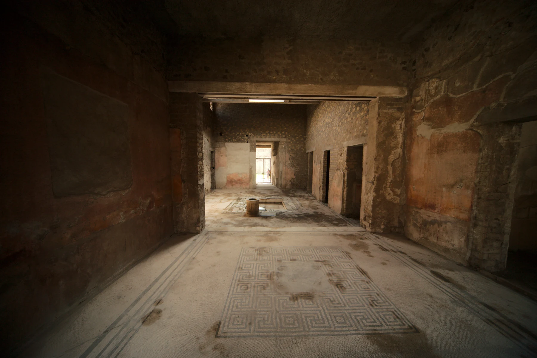
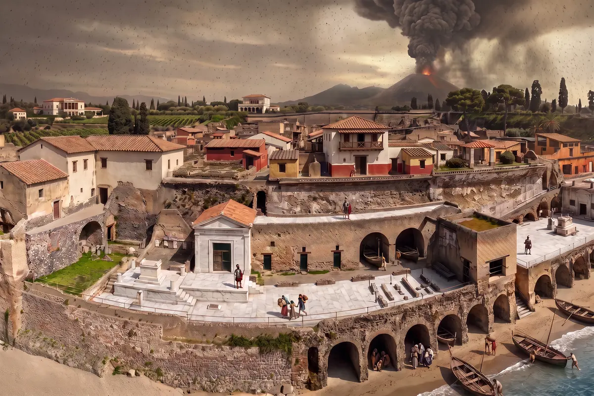 01AI vision79The night on the beachFrom the beach with its boats on the afternoon of the eruption through the surge of the night, the vineyards of Resina above the buried town and Maiuri’s excavation to today: the time journey from the ramp.Start the journey 02Real photoAD 79The historyFrom the town by the sea through the night of the pyroclastic flows, the Bourbon tunnels and the library of the Villa of the Papyri to the skeletons in the boat houses.Read the history 03Checked 25 Sep 20262026Tickets & admission€16, €2 for EU citizens aged 18 to 25, free on the first Sunday, opening hours, the Circumvesuviana from Naples, and the question: Pompeii or Herculaneum?Plan your visit
 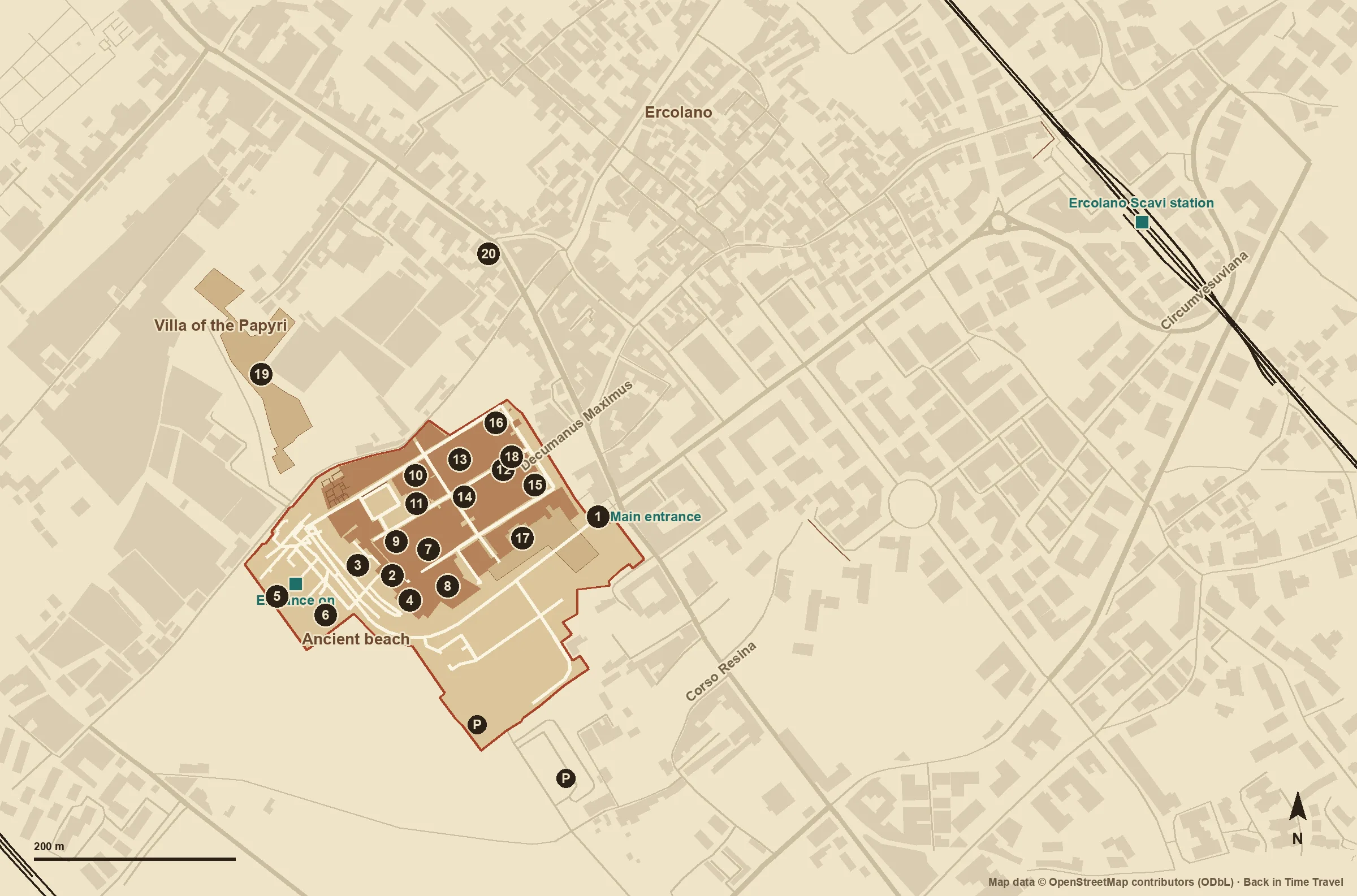 04Own plan20 sitesThe mapPlan of the excavations with the boat houses, the terrace of Balbus, the houses with upper floors, the baths, entrances, station and car park.Open the map
 Herculaneum in brief
Herculaneum in brief
Where is Herculaneum?
In Ercolano on the Bay of Naples, ten kilometres south-east of Naples and ten kilometres north-west of Pompeii, at the foot of Vesuvius. Ercolano Scavi station on the Circumvesuviana is ten minutes’ walk uphill from the entrance on Corso Resina.
When was Herculaneum destroyed?
In AD 79, in the same eruption of Vesuvius as Pompeii, but differently: on the first day little pumice fell here; in the night came surges and mudflows that buried the town under about twenty metres. The exact date, 24 August or autumn, is disputed.
What can you see today?
About four and a half hectares of excavated town: houses with upper floors and carbonised wood, the Forum Baths and the Suburban Baths, the palaestra, the terrace of Balbus, the ancient beach with the boat houses, the Antiquarium and the Boat Pavilion. The Villa of the Papyri and the theatre are not freely accessible at present.
How long do you need?
Two to three hours for the town, half a day with the Antiquarium and the beach. Herculaneum and Pompeii in one day is possible by Circumvesuviana but long; our tickets page helps you choose.
Looking beyond the bay
At the same
time, elsewhere.
When Herculaneum was destroyed in AD 79, the Colosseum in Rome was just being finished, Teotihuacan was laying out the Avenue of the Dead, and Tikal was counting its first kings. Drag the marker and discover the other sites.
- 100 BC – 79 AD A city still inhabited
- 600 BC – 90 BC Before Rome
- 89 BC – 61 AD Roman municipium
- 62 AD – 78 AD After the earthquake
- 79 AD – 79 AD The destruction
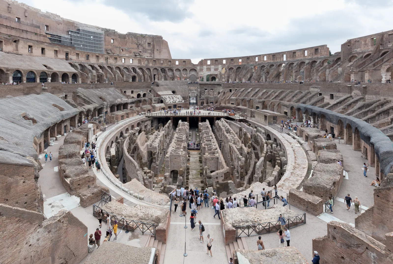
- 500 BC – 200 BC The Forum of the Republic
- 199 BC – 1 BC Villas on the Palatine
- 1 AD – 79 AD Nero’s lake in the valley
- 80 AD – 437 AD The amphitheatre in use
- 438 AD – 599 AD Last games
- 600 AD – 1348 AD Fortress, workshop, quarry
- 1349 AD – 1500 AD After the earthquake of 1349
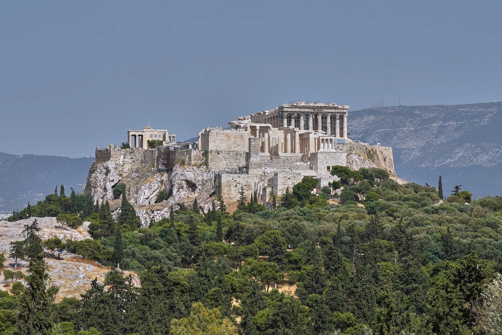
- 600 BC – 481 BC Before the Parthenon
- 480 BC – 448 BC After the Persian destruction
- 447 BC – 433 BC A monument takes shape
- 432 BC – 399 AD The Classical ensemble
- 400 AD – 1000 AD New uses, the same rock
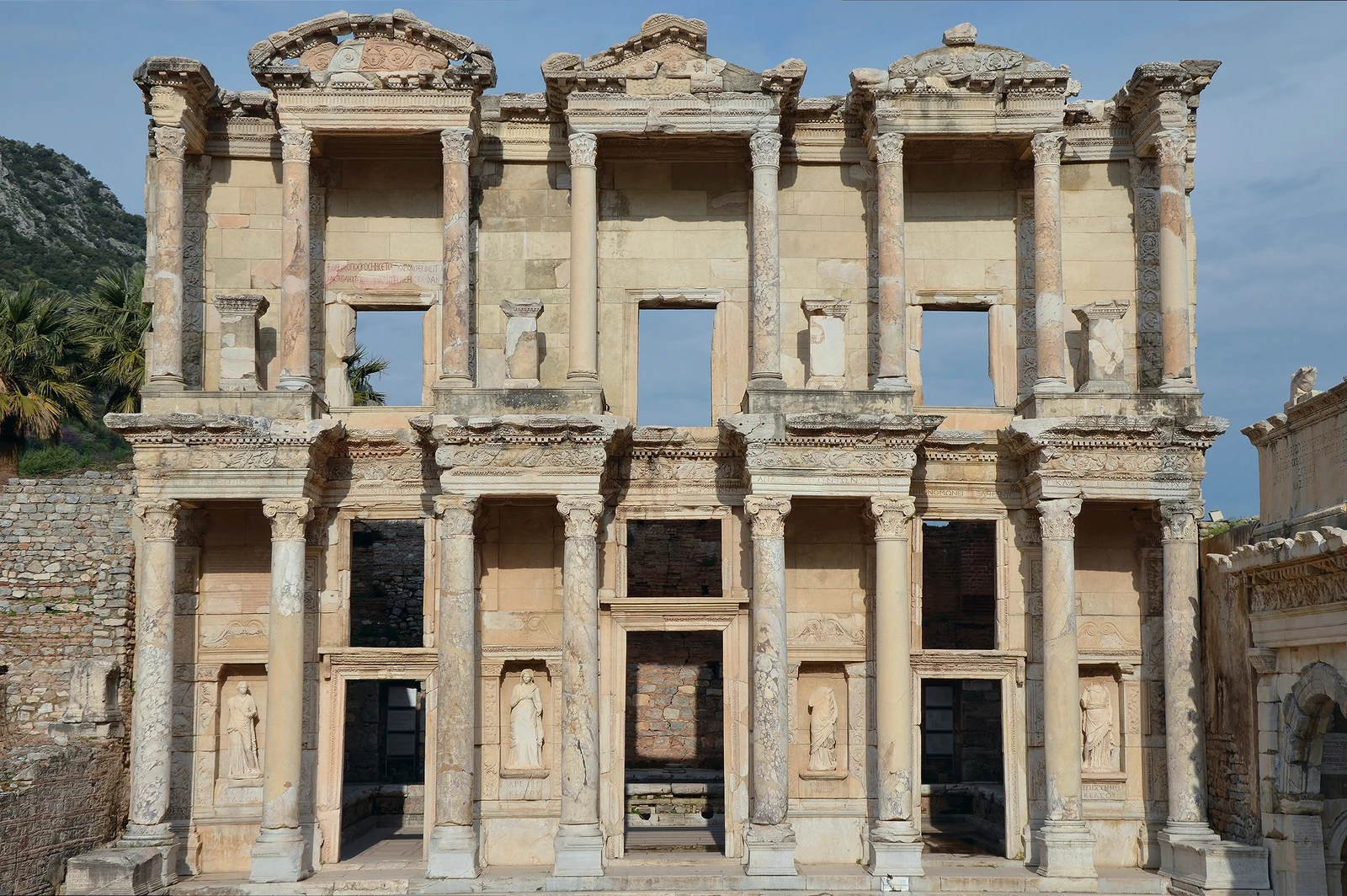
- 300 BC – 1 BC A Hellenistic framework
- 1 AD – 149 AD Roman living spaces
- 150 AD – 269 AD The age of the library
- 270 AD – 800 AD A building changes its role
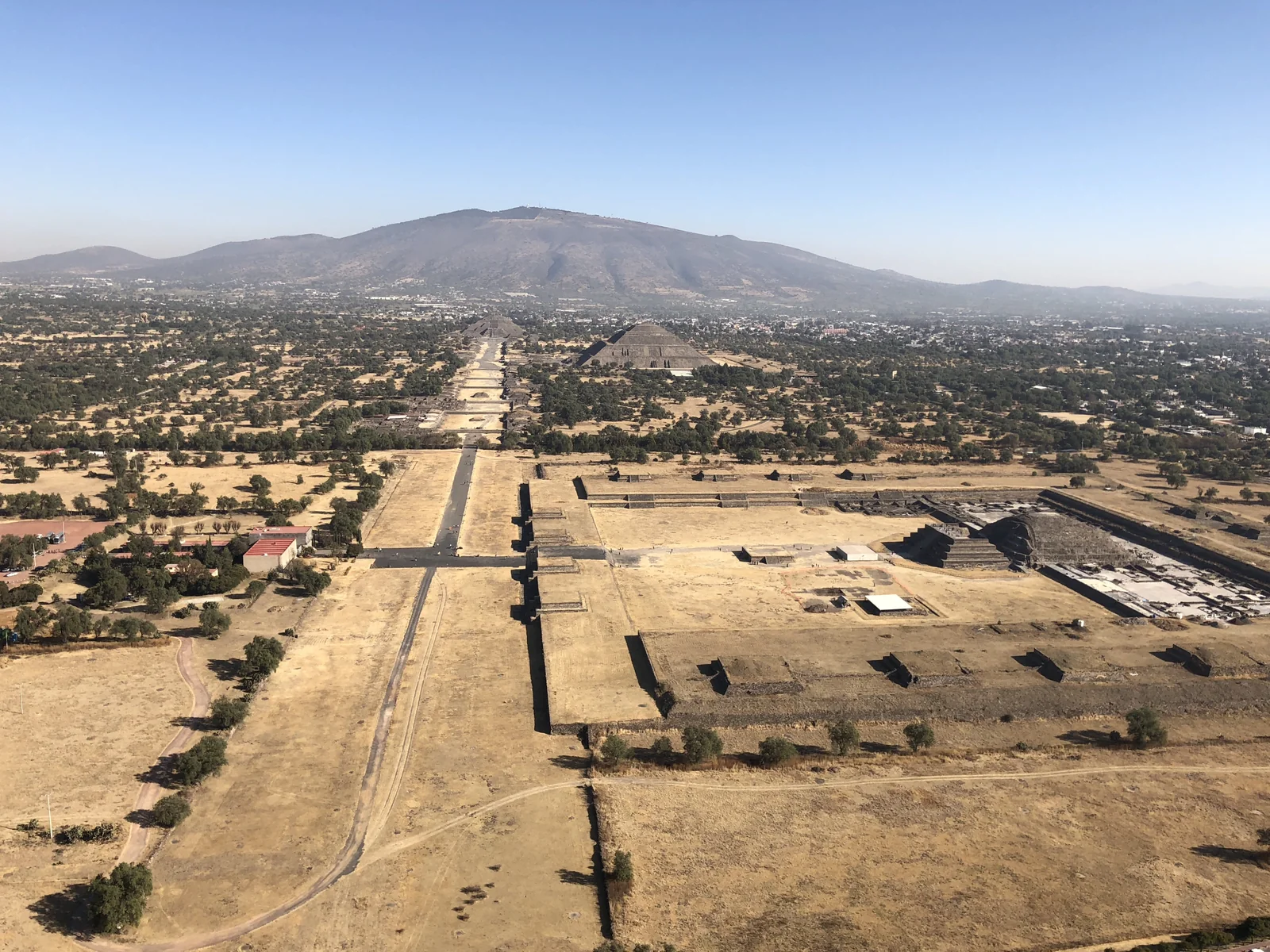
- 1 AD – 149 AD The city grows
- 150 AD – 249 AD An axis for the city
- 250 AD – 599 AD Life between the monuments
- 600 AD – 700 AD A centre in transition
- 600 BC – 199 AD Before the great temples
- 200 AD – 694 AD A Classic Maya city
- 695 AD – 733 AD After the victory over Calakmul
- 734 AD – 799 AD Monument and memory
- 800 AD – 950 AD An urban world in transition
- 600 AD – 849 AD Old Chichén
- 850 AD – 899 AD Between two cities
- 900 AD – 1049 AD The florescence of the new city
- 1050 AD – 1199 AD After the fall
- 1200 AD – 1250 AD The age of Mayapán
- 800 AD – 1112 AD Before Angkor Wat
- 1113 AD – 1150 AD A temple takes shape
- 1151 AD – 1180 AD After the builder
- 1181 AD – 1295 AD The age of Jayavarman VII and after
- 1296 AD – 1350 AD Zhou Daguan’s Angkor
- 1351 AD – 1430 AD Droughts and monsoons
- 1431 AD – 1500 AD The capital moves on
The bands show editorial windows from our stories, not complete settlement histories. Window boundaries organise the narrative; not every change can be dated to a single year. Photographs show the surviving condition, not the selected year. Present-day coastlines provide orientation.
From your screen to the ramp
Experience Herculaneum yourself
The park opens daily at 8.30 am, until 7.30 pm in summer; the ticket costs €16, online from CoopCulture or at the booth on Corso Resina. Tours from Naples bundle train, ticket and guide; if you come on your own, walk down the ramp and the town lies before you.
Affiliate link: we may receive a commission when you book through GetYourGuide. The historical interpretation remains independent.
Sources and context
This overview relies on UNESCO, the Parco Archeologico di Ercolano and the Herculaneum Conservation Project; each subpage cites its sources alongside the content.
- UNESCO: Archaeological Areas of Pompei, Herculaneum and Torre Annunziata
- Parco Archeologico di Ercolano: The Story (foundation, 89 BCE, excavations 1828–1875 and 1927–1958)
- Parco Archeologico di Ercolano: The Eruption (400 degrees, 20 metres, the boat of 3 August 1982)
- Parco Archeologico di Ercolano: tickets and opening hours
- Herculaneum Conservation Project (since 2001)
Images and usage rights
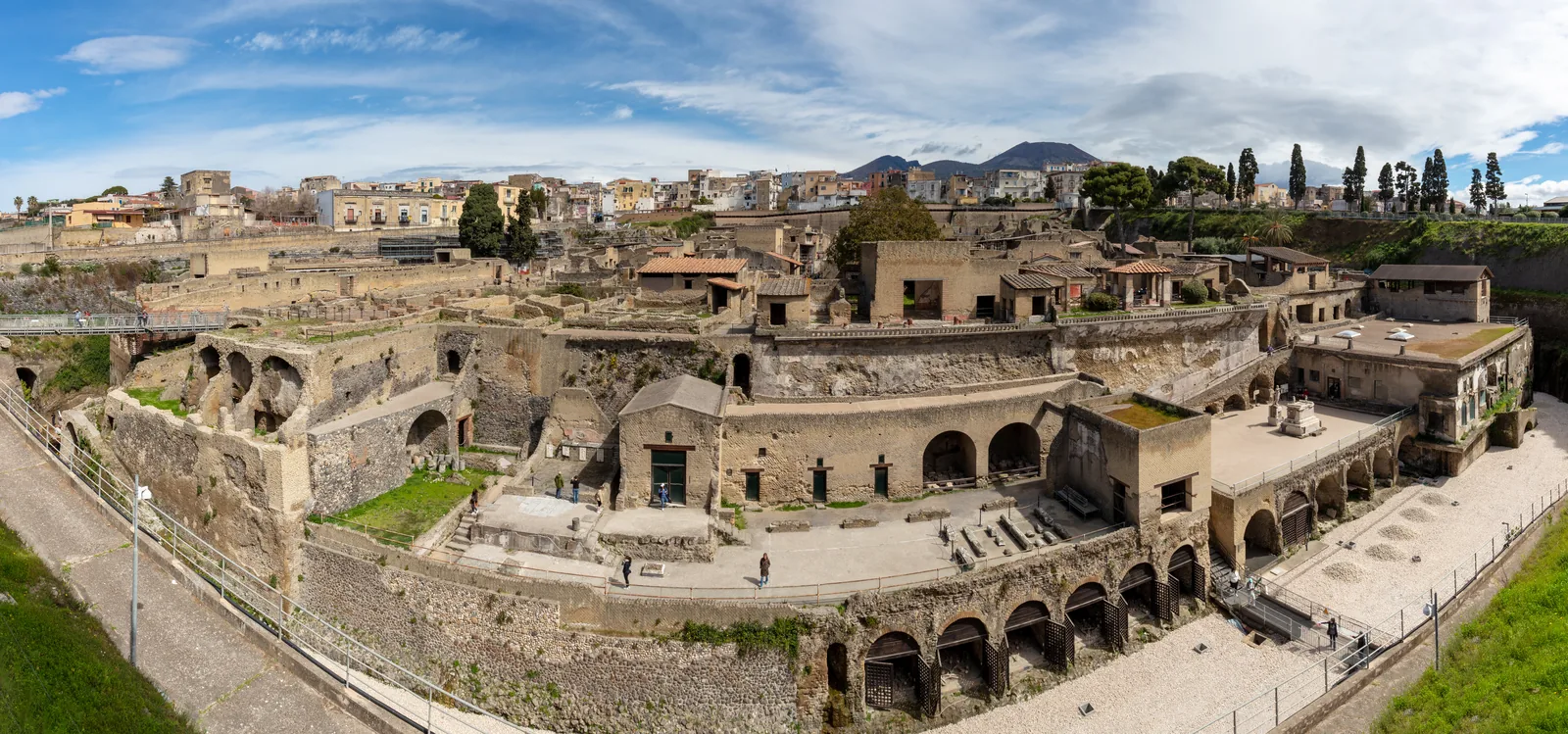
Panorama of the excavations from the access ramp: photo Diego Delso, 2023, CC BY-SA 4.0, via Wikimedia Commons. Map: own plan based on OpenStreetMap data (ODbL).
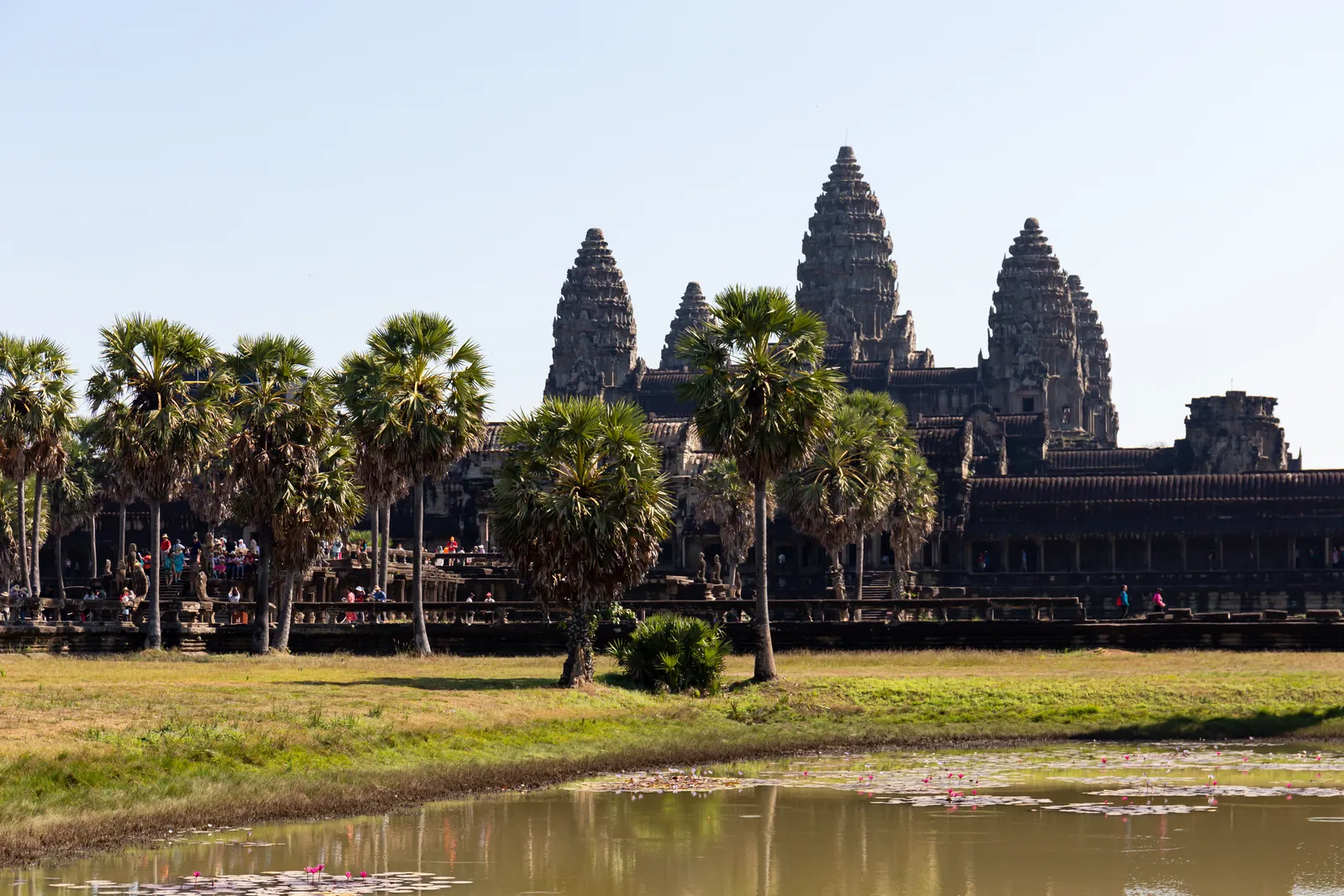
Angkor Wat from the west across the lotus pond, photographed on 10 December 2019. Balon Greyjoy / Wikimedia Commons · CC0 1.0. Resized to 1600 pixels wide and converted to WebP; no cropping or content alterations. Framing varies by screen. Derived photograph under the same licence.

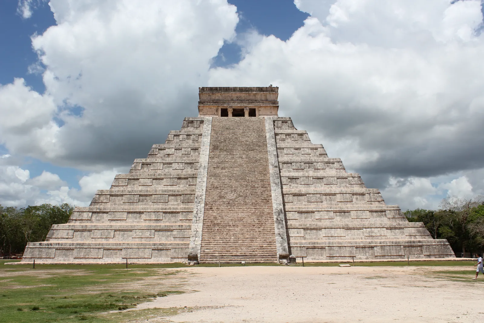
The Kukulcán pyramid (El Castillo) at Chichén Itzá, north side with the restored stairway, seen from the Great Platform. Photograph taken on 31 May 2013. Arian Zwegers / Wikimedia Commons · CC BY 2.0. Resized to 1600 pixels wide and compressed as WebP; no crop or content alterations. Framing varies by screen. Derived photograph under the same licence.
.jpg)
The excavations of Herculaneum seen from the access ramp: the boat houses on the ancient beach below, above them the terrace of Marcus Nonius Balbus, the town and Vesuvius; modern Ercolano on top. Photograph taken on 27 March 2023. Diego Delso / Wikimedia Commons · CC BY-SA 4.0. Resized to 1600 pixels wide and compressed as WebP; no crop or content alterations. Framing varies by screen. Derived photograph under the same licence.

View from the upper tier into the Colosseum: the exposed hypogeum, the partly reconstructed arena floor and the tiers opposite. Photograph taken on 15 September 2022. Diego Delso / Wikimedia Commons · CC BY-SA 4.0. Resized to 1600 pixels wide and compressed as WebP; no crop or content alterations. Framing varies by screen. Derived photograph under the same licence.

View from the Pnyx towards the Acropolis of Athens and the Parthenon, photographed on 20 May 2020. George E. Koronaios / Wikimedia Commons · CC BY-SA 4.0. Resized to 1600 pixels wide and converted to WebP; no cropping or content alterations. Framing varies by screen. Derived photograph under the same licence.

The façade of the Library of Celsus in Ephesus, Turkey, photographed on 8 April 2015. Carole Raddato / Wikimedia Commons · CC BY-SA 2.0. Resized to 1600 pixels wide and converted to WebP; no cropping or content alterations. Framing varies by screen. Derived photograph under the same licence.
.jpg)
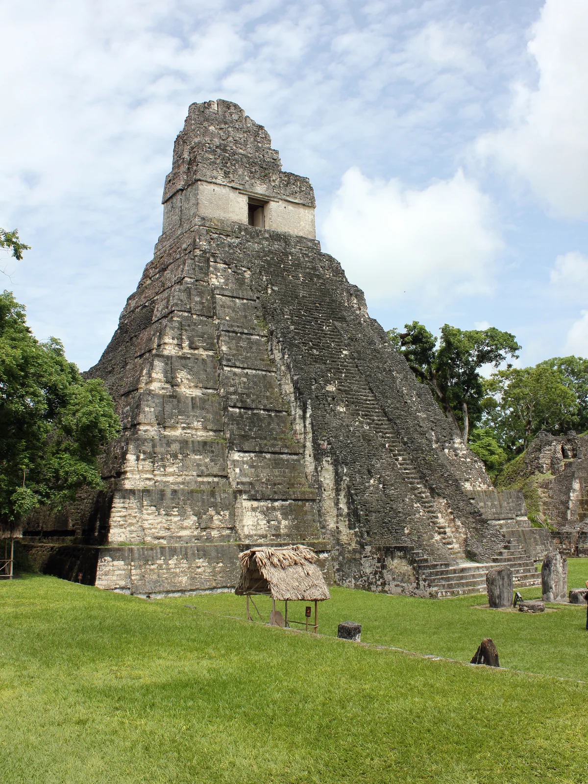
Temple I at the Great Plaza of Tikal, Guatemala. Photograph taken on 26 June 2015. Kaldari / Wikimedia Commons · CC0 1.0. Resized to a maximum edge of 1600 pixels and compressed as WebP; no crop or content alterations. Framing varies by screen. Derived photograph under the same licence.

View across the Avenue of the Dead at Teotihuacan: the Pyramid of the Sun stands to the right, with the Pyramid of the Moon at the far end of the axis. Photograph taken on 27 December 2017. Ralibreros112 / Wikimedia Commons · CC BY-SA 4.0. Resized to a maximum edge of 1600 pixels and compressed as WebP; no crop or content alterations. Framing varies by screen. Derived photograph under the same licence.

The Great Plaza of Tikal with Temple I, seen from Temple II; the North Acropolis stairway on the left, the Central Acropolis on the right. Photograph taken on 21 July 2010. Mario Bollini / Wikimedia Commons · CC BY 2.0. Resized to 1600 pixels wide and compressed as WebP; no crop or content alterations. Framing varies by screen. Derived photograph under the same licence.

Natural Earth / world-atlas · Licences