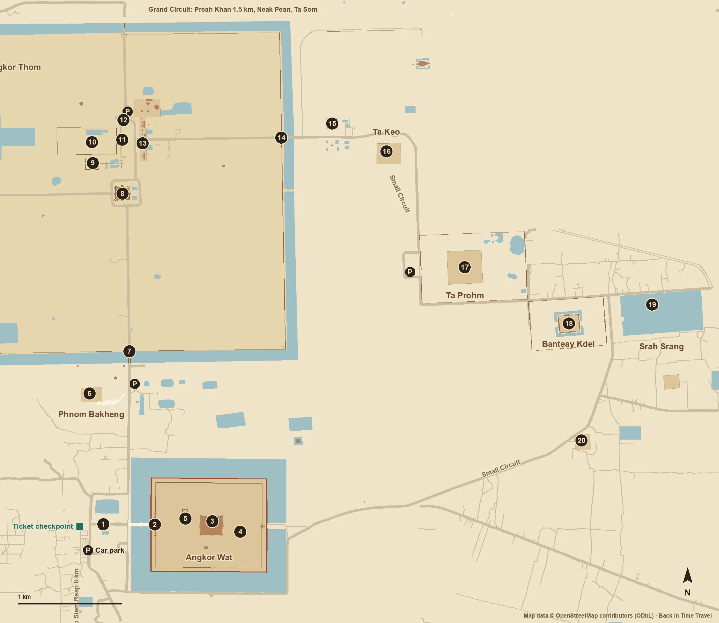
The west front of Angkor Wat with the towers of the central temple behind sugar palms, with lawn and a lotus pond in the foreground.
Angkor Wat from the west across the lotus pond, photographed on 10 December 2019. Balon Greyjoy · CC0 1.0

Cambodia · Khmer

Angkor Wat.
A temple, a city.

Five towers above a pond, an image that appears on Cambodia’s flag. Yet the temple never stood alone: around it lay the largest urban landscape of the preindustrial world. Begin by asking what the photograph shows, and what lies beneath.

1150CE
Selection: 800–1500 CE8 chapters
The history
Angkor is more than Angkor Wat.

Angkor Wat is the most famous temple, but only one of many in the Angkor Archaeological Park. Across some 400 square kilometres lie the remains of several capitals of the Khmer Empire from the 9th to the 15th century, with temples, reservoirs, dykes and canals. Source: UNESCO · Angkor

Through the centuries

No place
stands still.

Choose a period. See how the story changes over time.

01Around 800Beginnings

An empire begins on the mountain.

On Phnom Kulen, some 30 kilometres north-east of Angkor, lies Mahendraparvata, an early capital of the Khmer Empire from the late 8th and early 9th centuries. Inscriptions link it with Jayavarman II, consecrated as king of kings in 802 according to tradition. Angkor Wat does not yet exist.

Source: UNESCO Tentative List · Phnom Kulen / Mahendraparvata
021113–c. 1150Construction

A temple for Vishnu.

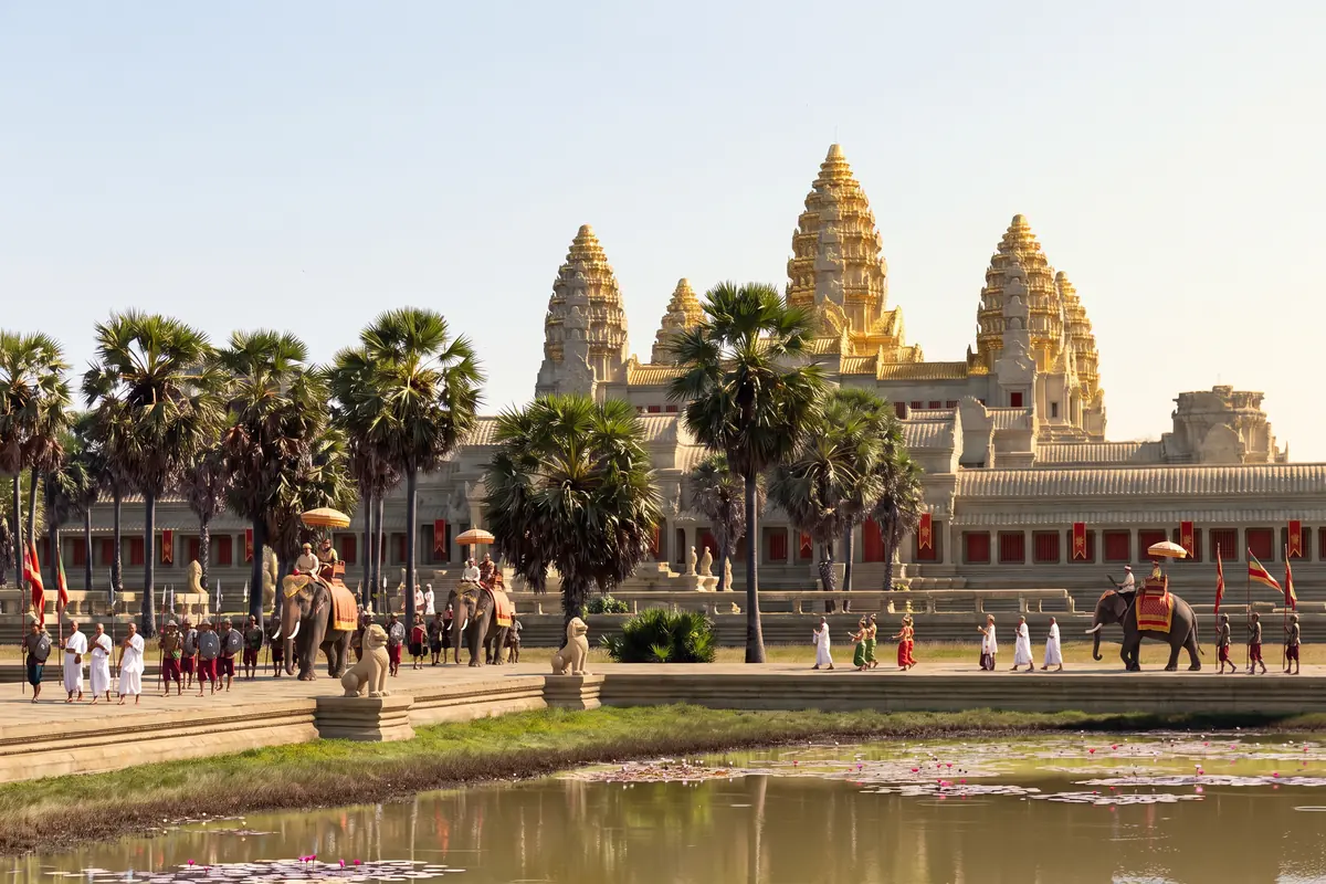
Under Suryavarman II, Angkor Wat is built as the state temple, taking some thirty years according to APSARA. Including its 190-metre-wide moat, the complex measures roughly 1,500 by 1,300 metres. Its westward orientation is unusual; the gallery reliefs show the king himself alongside scenes from the epics.

Source: APSARA National Authority · Angkor Wat
031181–c. 1220New capital

Angkor Thom and the Bayon.

After the Cham occupation (1177–1181), Jayavarman VII fortifies the capital Angkor Thom with twelve kilometres of walls and five gates. At its centre stands the Bayon, a Buddhist temple with face towers. Angkor Wat lies to the south and remains in use.

Source: APSARA National Authority · Angkor Thom
0616th–17th centuriesPilgrimage

Monks, pilgrims and a plan from Japan.

Angkor Wat becomes a Theravada Buddhist temple and draws pilgrims from across South-East Asia. Japanese visitors leave ink inscriptions between 1612 and 1632; the best known is by Morimoto Kazufusa in 1632. A 17th-century Japanese drawing is regarded as the oldest plan of the temple.

Source: Yoshiaki Ishizawa · The World’s Oldest Plan of Angkor Vat, Udaya 13 (2015)
071860–1908Research

Mouhot, then the Conservation d’Angkor.

Henri Mouhot visits Angkor in 1860; his posthumously published travel accounts make the site famous in Europe. In 1907 the École française d’Extrême-Orient is charged with studying and preserving Angkor, and in 1908 it founds the Conservation d’Angkor. The temple was never “lost”: monks continued to live there.

Source: École française d’Extrême-Orient · Centre de Siem Reap
081992 to todayWorld Heritage

Protection, lidar and many visitors.

Angkor becomes a World Heritage Site in 1992, and the APSARA authority for its protection and management follows in 1995. The park’s population still lives in more than a hundred villages. Since 2012, airborne laser scanning has shown how large the city around the temples really was.

Source: UNESCO · Angkor
Swipe or scroll

Look closer

The city was larger than the temple.

In 2012 researchers flew over Angkor with lidar, a laser scanner that maps the ground beneath the forest. The data revealed a previously undocumented, formally planned urban landscape into which Angkor Wat was integrated: street grids, house mounds, ponds and canals. Angkor is therefore regarded as the largest settlement complex of the preindustrial world.

Source: Evans et al. · Uncovering archaeological landscapes at Angkor using lidar, PNAS 110 (2013)
What the evidence cannot show
Lidar measures the shape of the ground, not its age. Which mounds and canals were used at the same time, and who lived there, can only be settled by excavation and dating. Our photograph remains unaltered; the city lies outside the frame.
What does “discovered” mean?
Mouhot’s account of 1860 is often told as a discovery. He himself describes a monastery with monks inside the temple and hears of travellers who came before him. Ask of every discovery story: unknown to whom, and who lived there all along?
Source: Henri Mouhot · Travels in the Central Parts of Indo-China, Vol. 2 (1864), Project Gutenberg

Reading the place

Beneath the surface.

Buildings and finds reveal more when we consider their context. These close readings connect the evidence with questions to take on a visit.

01

How do you see a city beneath the trees?

During the lidar survey of 2012 a laser scanned the ground under the canopy. The elevation data produced a terrain model in which a regular network of roads, house mounds and ponds appears around Angkor Wat, never mapped before. The temple was part of a planned urban space.

Evidence / source: Evans et al. · Uncovering archaeological landscapes at Angkor using lidar, PNAS 110 (2013)

Read the lawn and trees in the photograph as a surface, not as emptiness. Where grass grows today, low ridges and hollows mark former streets, house platforms and water basins. The laser reads that shape; the eye overlooks it. A free-standing monument becomes a centre surrounded by everyday life: housing, water, routes.

What the evidence cannot establish on its own

A terrain model dates nothing. Whether two mounds were occupied at the same time or centuries apart is decided by excavation and finds. The city’s population also remains an estimate with a wide range.

02

Water sustained the city and threatened it.

Tree rings from southern Vietnam provide a climate record spanning seven and a half centuries. For the 14th and 15th centuries they show decades-long droughts interrupted by extreme monsoon years. Both strained Angkor’s water network: drought the supply, heavy rain the canals and embankments.

Evidence / source: Buckley et al. · Climate as a contributing factor in the demise of Angkor, PNAS 107 (2010)

Think of the barays, the vast reservoirs, and of the moat of Angkor Wat as more than display. They belonged to a system of canals that collected, distributed and discharged water. Such a network is strong while it is maintained and vulnerable when extremes accumulate. Questions of climate, maintenance and politics are connected here.

What the evidence cannot establish on its own

The climate data document droughts, not their consequences in detail. The study explicitly calls climate one factor among several. It does not supply a single cause for Angkor’s loss of importance.

03

Why does the temple face west?

Almost all temples at Angkor open to the east. Angkor Wat faces west. APSARA points to Brahmanic funerary rites performed in reverse order; accordingly the reliefs are read anticlockwise. The galleries show Suryavarman II himself, battles from the Mahabharata and the Churning of the Sea of Milk.

Evidence / source: APSARA National Authority · Angkor Wat

Take the orientation as a question onto the causeway: arriving from the west you see the complex as it was meant to be seen, with the sunset behind you. The reliefs are then not decoration but a programme placing the builder within an order of gods and epics. The sequence of images is part of the message.

What the evidence cannot establish on its own

The reading as a funerary temple is the most widespread, not the only one. The westward orientation alone does not establish where, or whether, the king was buried. The dating of individual reliefs also remains a research question; the north-east corner was only completed in the 16th century.
Plan a visit

Plan Angkor with time and a pass.

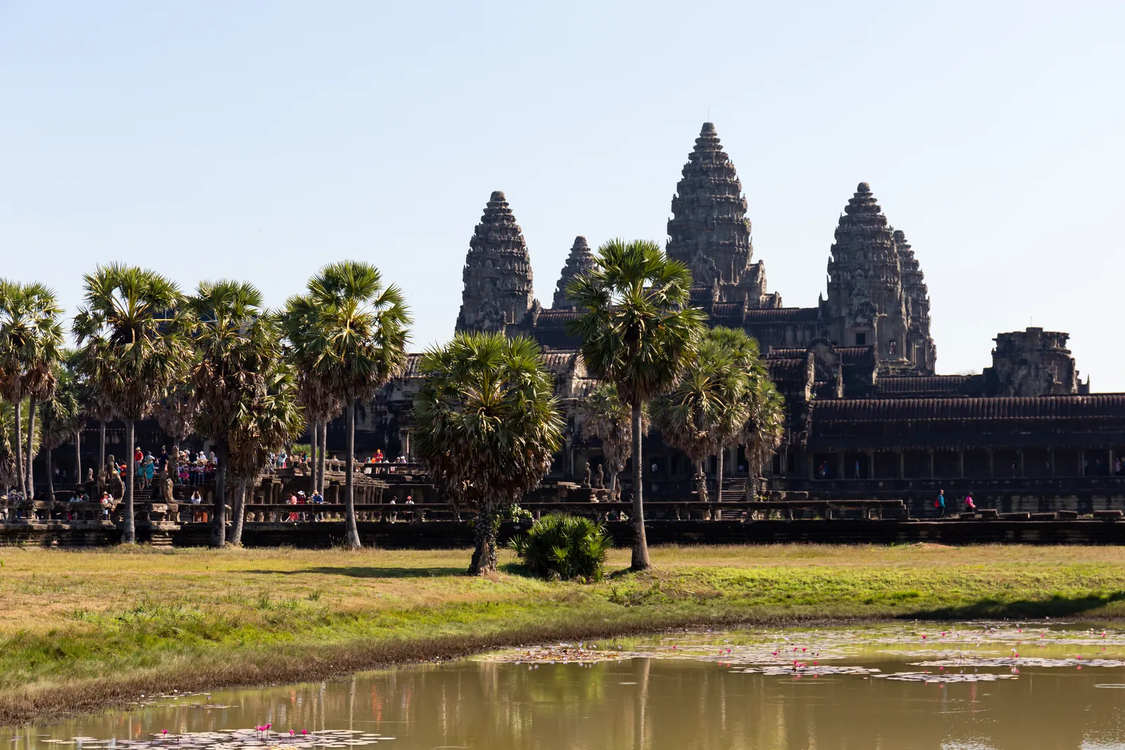
The Angkor Pass is sold officially online by Angkor Enterprise for one, three or seven days. The park opens at five in the morning; Angkor Wat is open until 5.30 pm, the upper Bakan only until 5 pm and not on Buddhist holy days. Allow at least two to three hours for Angkor Wat alone, and treat Angkor Thom with the Bayon as a separate destination.

Check whether any offer includes the Angkor Pass; tuk-tuk rides and many tours do not. A driver and a licensed guide are different services. Clothing covering shoulders and knees is compulsory, and children under twelve are not admitted to the Bakan.

Affiliate link: we may receive a commission when you book through GetYourGuide. The historical interpretation remains independent.

Visiting sources checked on 24 September 2026. Prices and availability are provided by the operator.

Keep exploring

More of
Angkor Wat.

Sources and context

These texts combine published research with editorial explanation. Some dates are approximate. Photographs show documented surviving conditions. Specialist archaeological review is still pending.

  1. Source: UNESCO · Angkor
  2. Source: UNESCO Tentative List · Phnom Kulen / Mahendraparvata
  3. Source: APSARA National Authority · Angkor Wat
  4. Source: APSARA National Authority · Angkor Thom
  5. Source: Zhou Daguan / Paul Pelliot · Mémoire sur les coutumes du Cambodge, BEFEO 2 (1902)
  6. Source: Carter et al. · Temple occupation and the tempo of collapse at Angkor Wat, PNAS 116 (2019)
  7. Source: Yoshiaki Ishizawa · The World’s Oldest Plan of Angkor Vat, Udaya 13 (2015)
  8. Source: École française d’Extrême-Orient · Centre de Siem Reap
  9. Source: Evans et al. · Uncovering archaeological landscapes at Angkor using lidar, PNAS 110 (2013)
  10. Source: Angkor Enterprise · Available tickets (Angkor Pass)
  11. Source: Henri Mouhot · Travels in the Central Parts of Indo-China, Vol. 2 (1864), Project Gutenberg
Images and usage rights

Angkor Wat from the west across the lotus pond, photographed on 10 December 2019. Balon Greyjoy / Wikimedia Commons · CC0 1.0. Resized to 1600 pixels wide and converted to WebP; no cropping or content alterations. Framing varies by screen. Derived photograph under the same licence.

Barlow OFL · Manrope OFL